Burgess Junction, WY, July 2025
We stayed at Garryowen, MT because Kate wanted to drive the Northern Route through Bighorn National Forest on Route 14. Route 14 through the forest is almost 60 miles south of Garryowen and about 35 miles long. In total, it is about 2 hours of driving, each way, due to switch backs and speed limits in the forest.
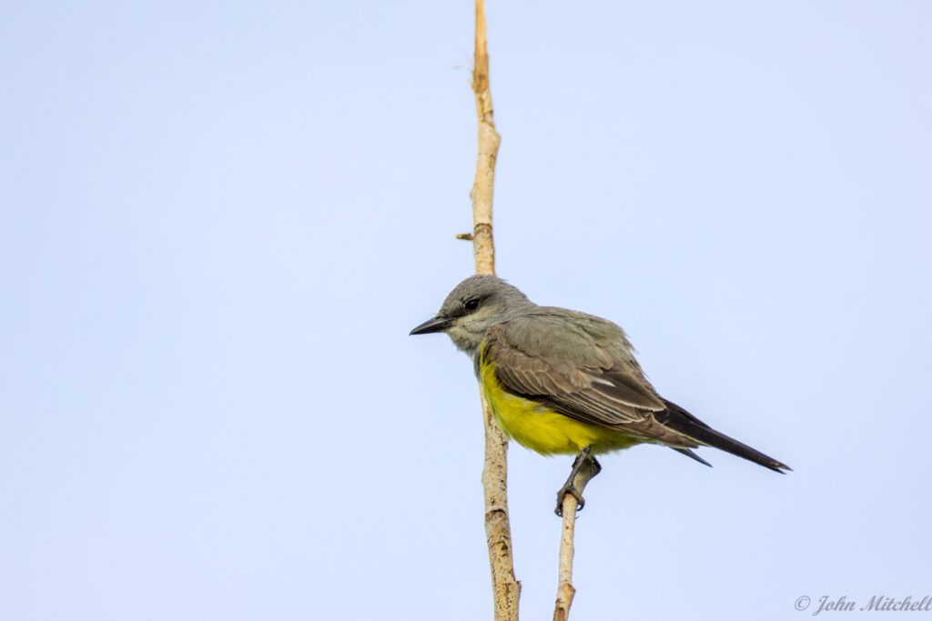
Before we left, a Western Kingbird was yelling at us from a nearby tree. The angry baby bird may already have been on the ground, but we had not seen it.
On the way, we stopped in Dayton, WY to get gas because we had to pass through the town anyway. It was a bit of a touristy town, but at least the gas was cheaper than in Yellowstone! It seemed more rundown than the southern entrance town, so maybe the north is less popular.
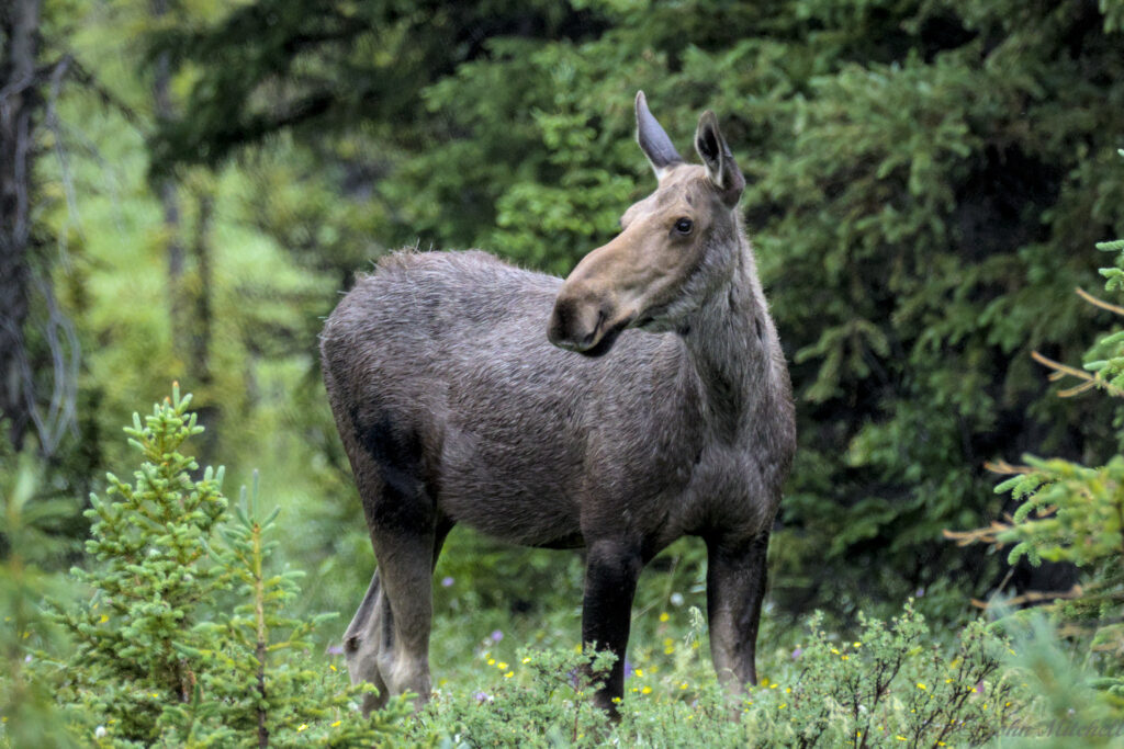
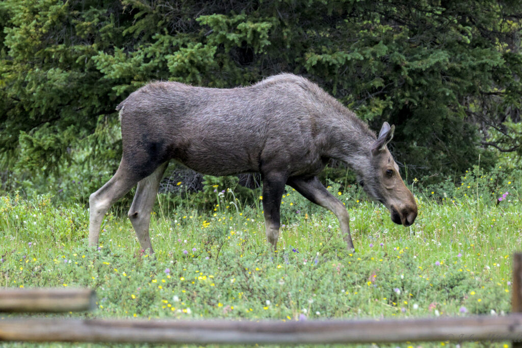
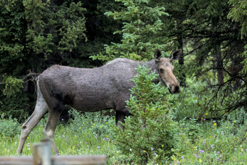
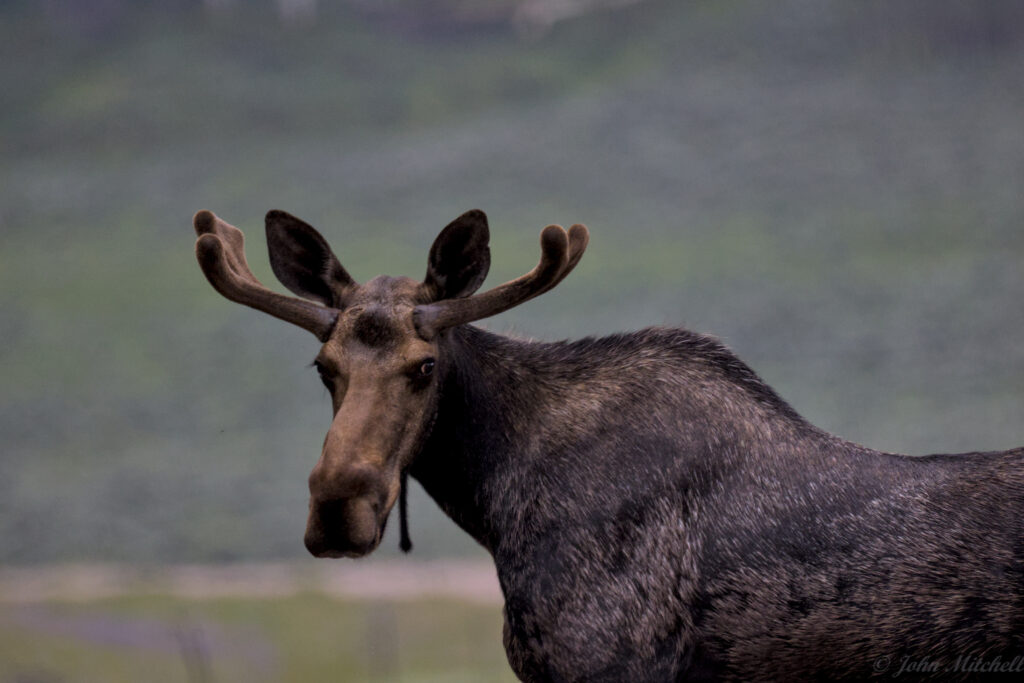
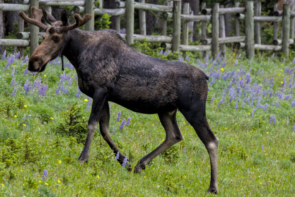
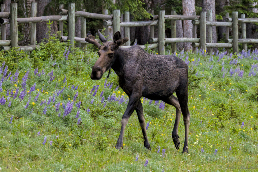
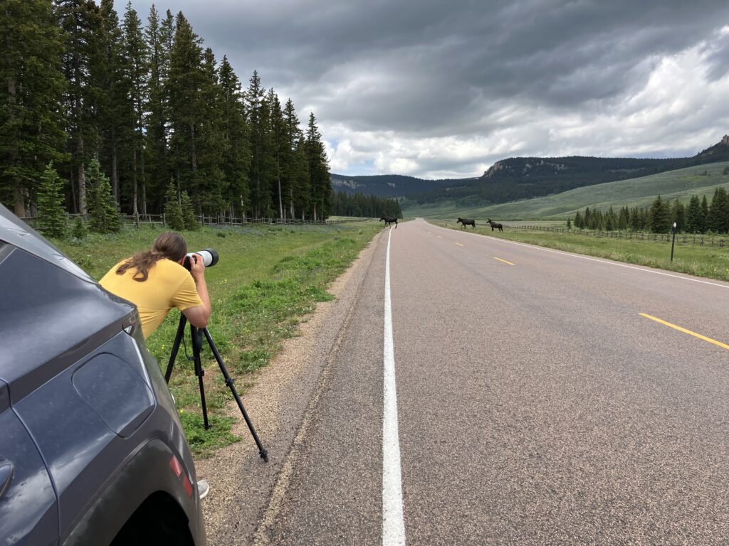
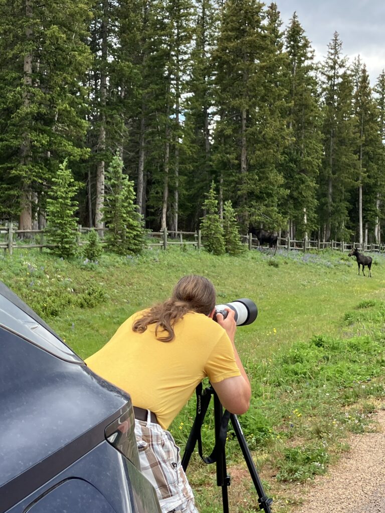
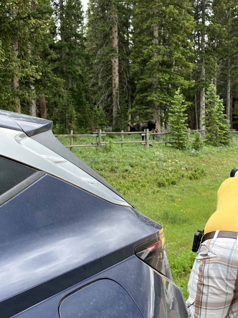
On the drive into the forest, we saw three moose, but similar to Yellowstone, someone was annoyed by the slowing cars and gunned their engine. The passing truck scared the moose off, so John got a few overly zoomed photos and a lot of moose butt photos. After he dies, anyone reviewing his photos will probably think he is an animal butt pervert.

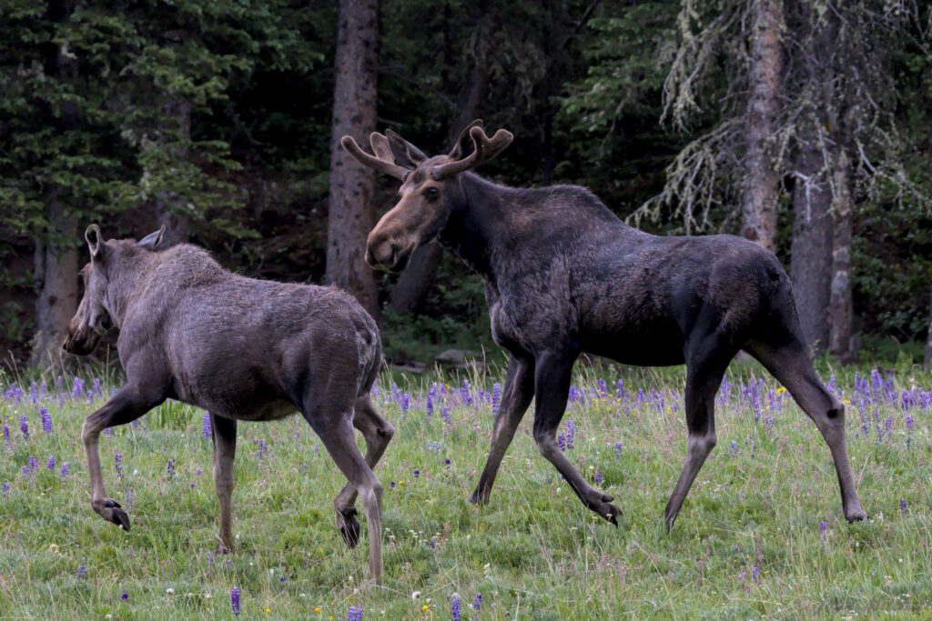
These are Shiras Moose. There are four species of moose in the United States, and Shiras Moose are the smallest. There are eight moose species world-wide.
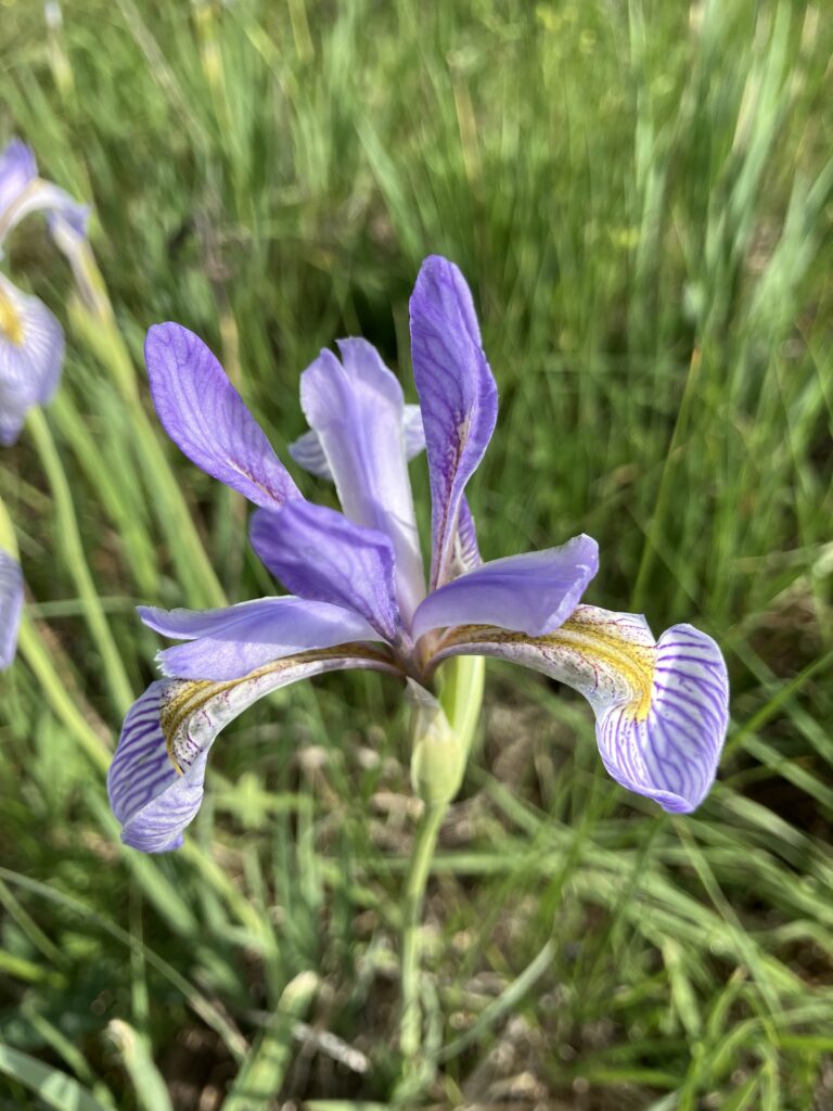
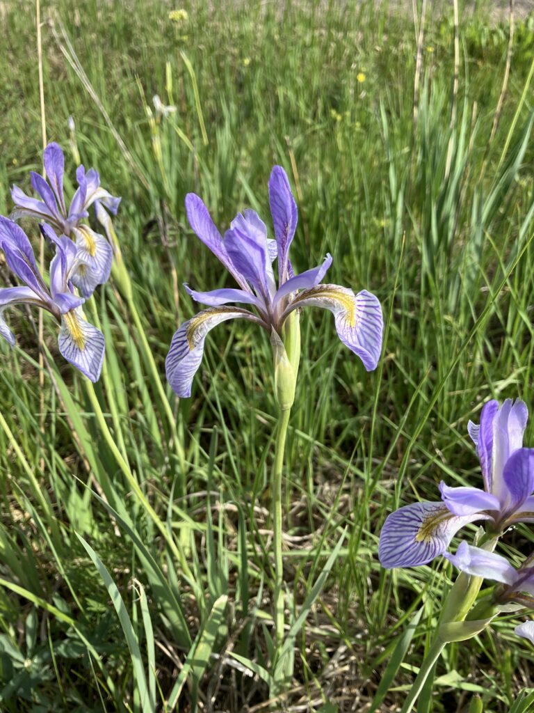
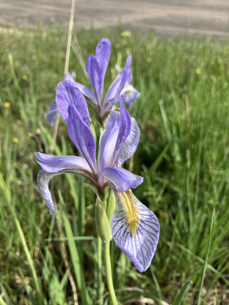
The park was surprisingly devoid of animals. There was some nice views, but they were not as good as the southern route or Yellowstone. The haze of humidity hanging over the forest was not doing the scenic views any favors. We made it to Burgess Junction Visitor Center without seeing significant numbers of animals; all we saw was a single Mule Deer. The visitor center was surrounded by patches of pretty purple irises, but the area needed a bit of a manicure.
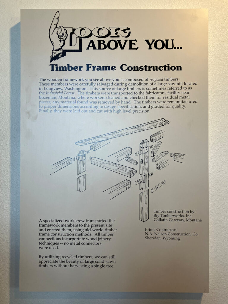
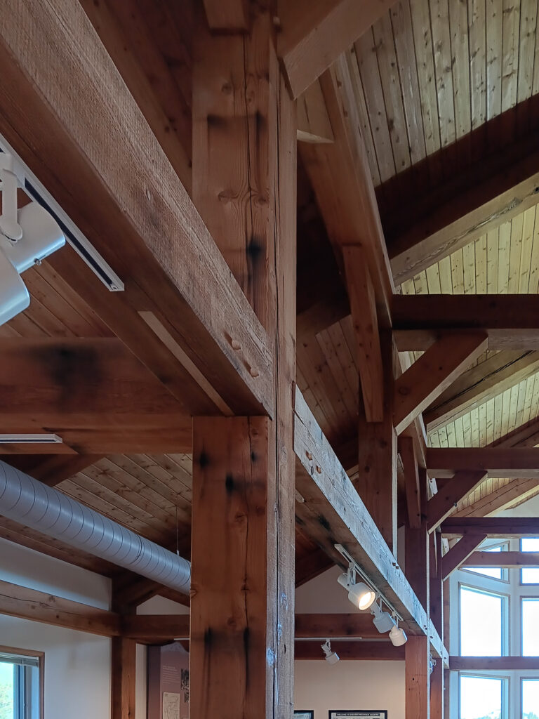
The inside has impressive wood joinery; the visitor center was built in an older style without any nails or screws.
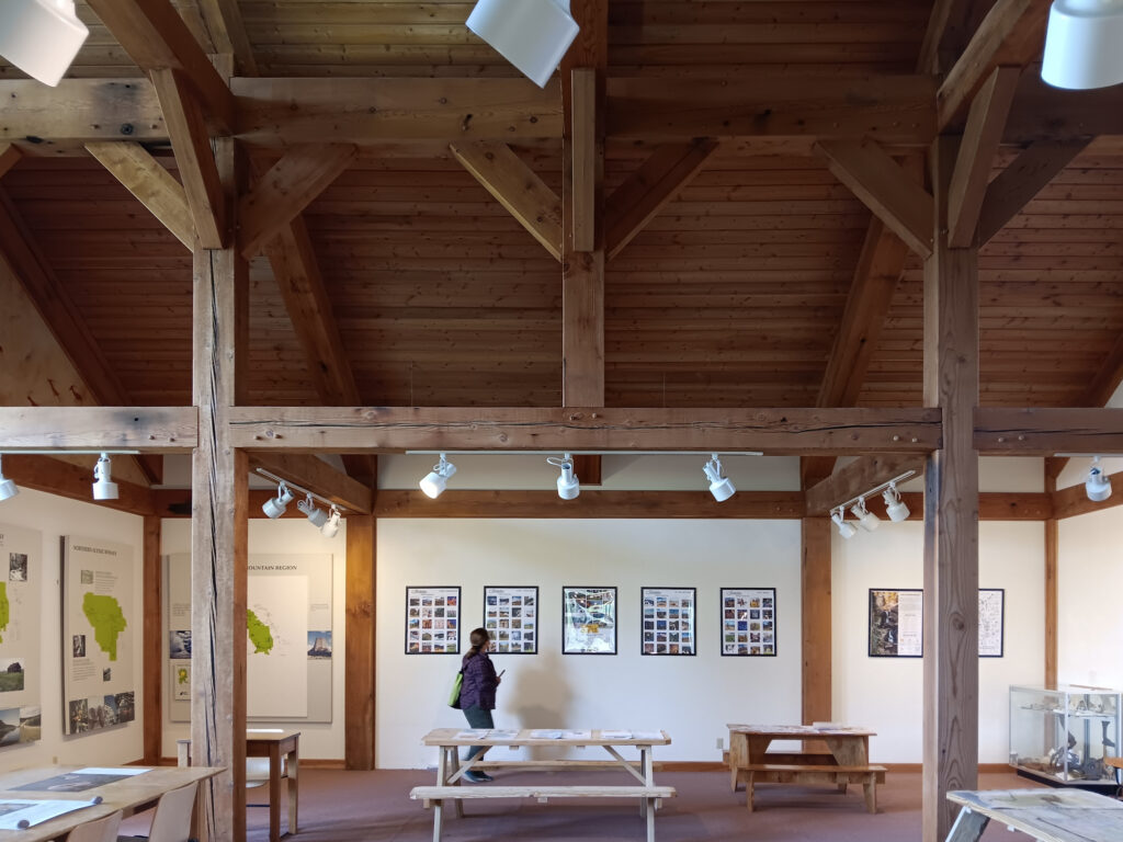
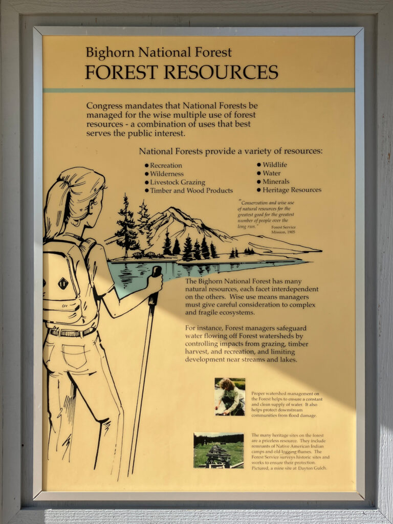
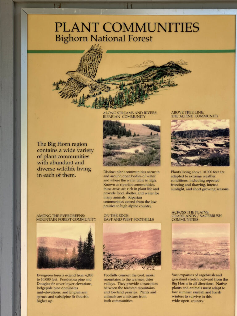
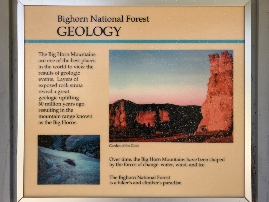
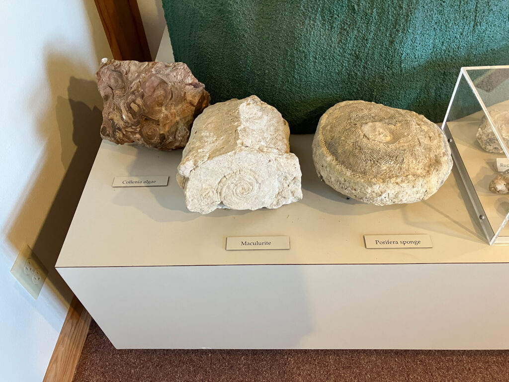
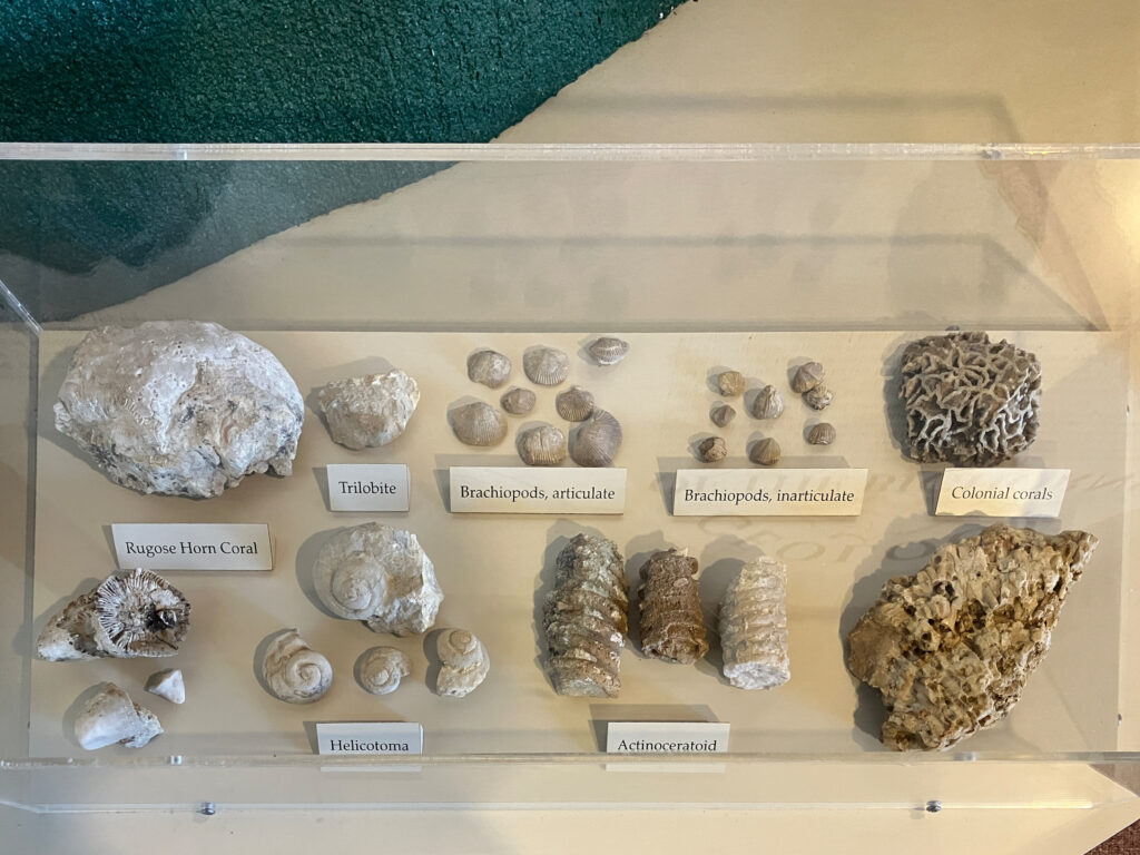
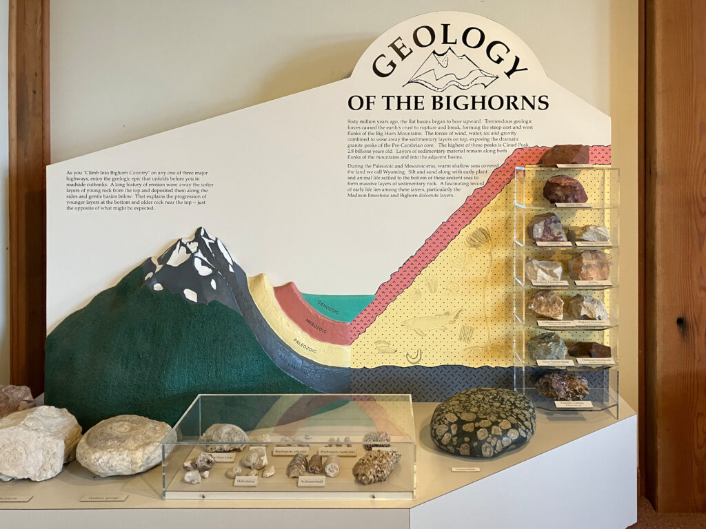
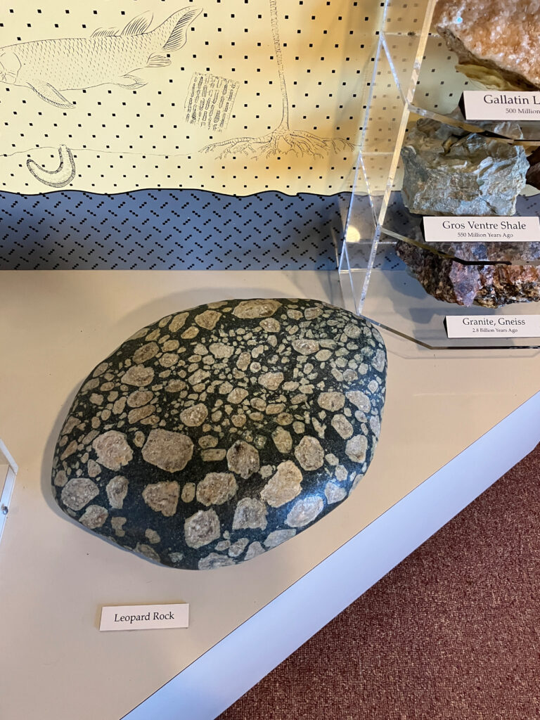
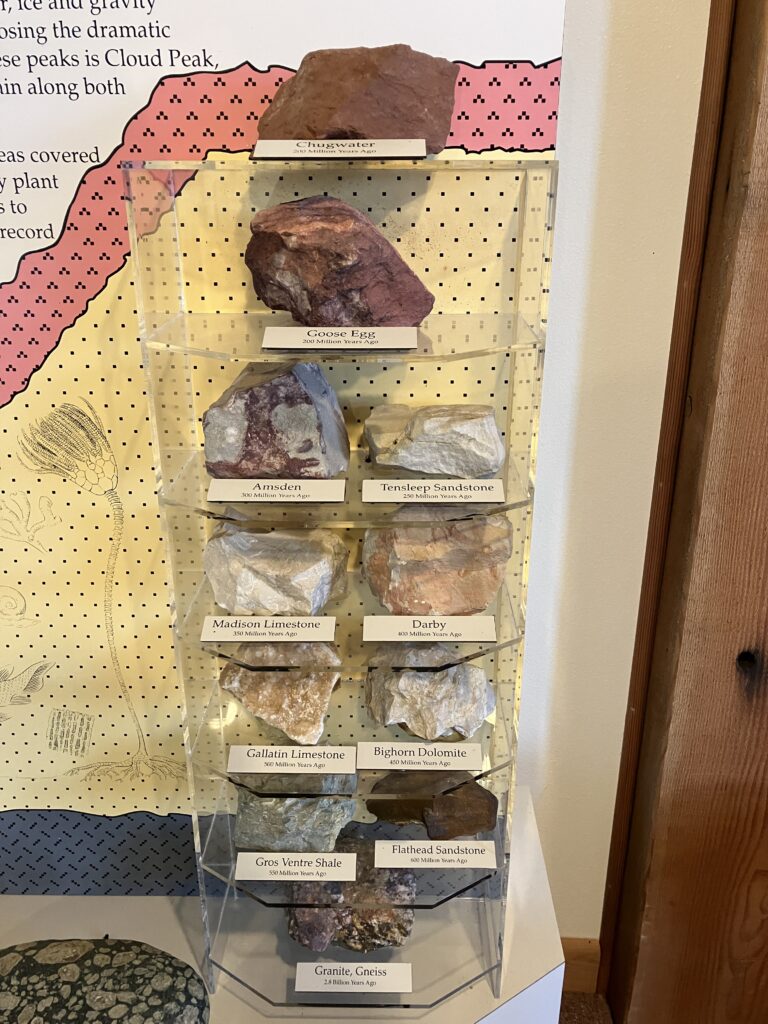
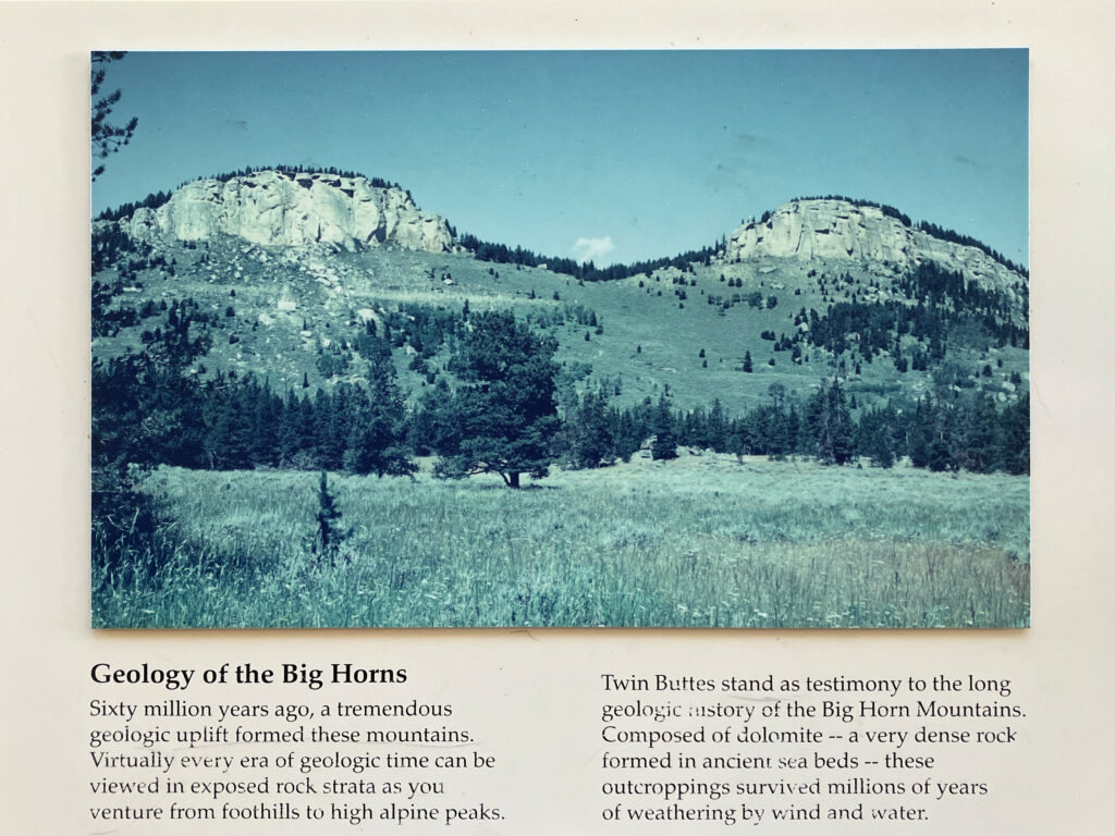
The visitor center exhibit area was full of informational signs. There was a section on geology. (On the drive through the park, there are signs with the age and name of the roadside rock formations.)
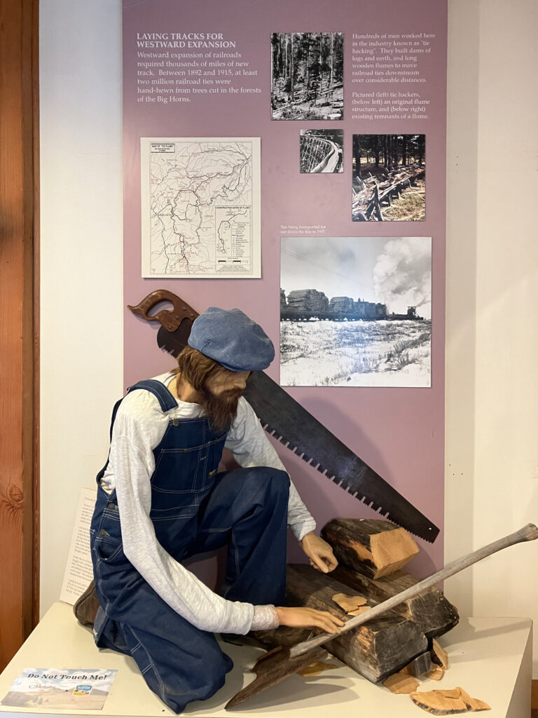
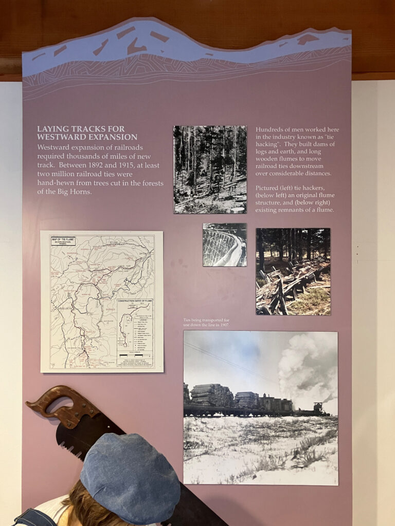
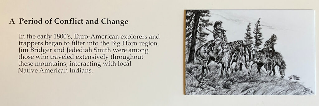
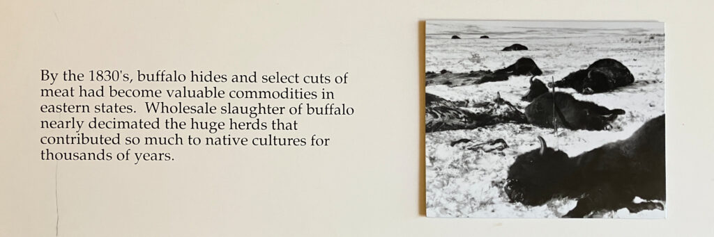
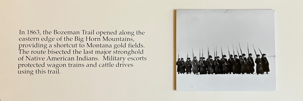
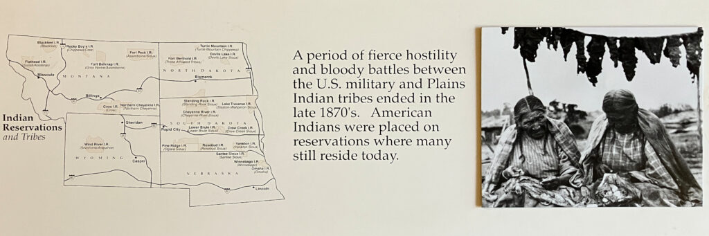
Some information about the westward expansion. (Clearly, medical facilities were not readily available; the poor man’s arm fell off and no one has fixed it.)
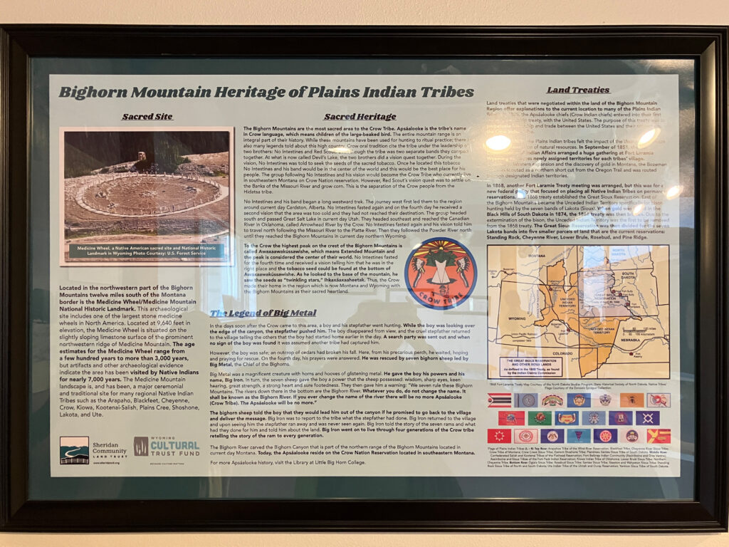
Signs about the local Indians and historic spots.
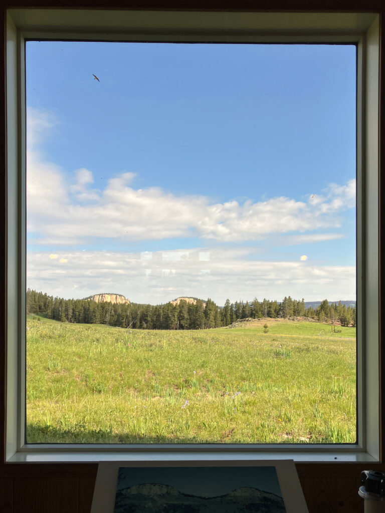
The Twin Buttes behind the visitor center are one of the more scenic views. The “framed picture” of the Twin Buttes with the bird flying by is actually a picture out the window in back of the visitor center.
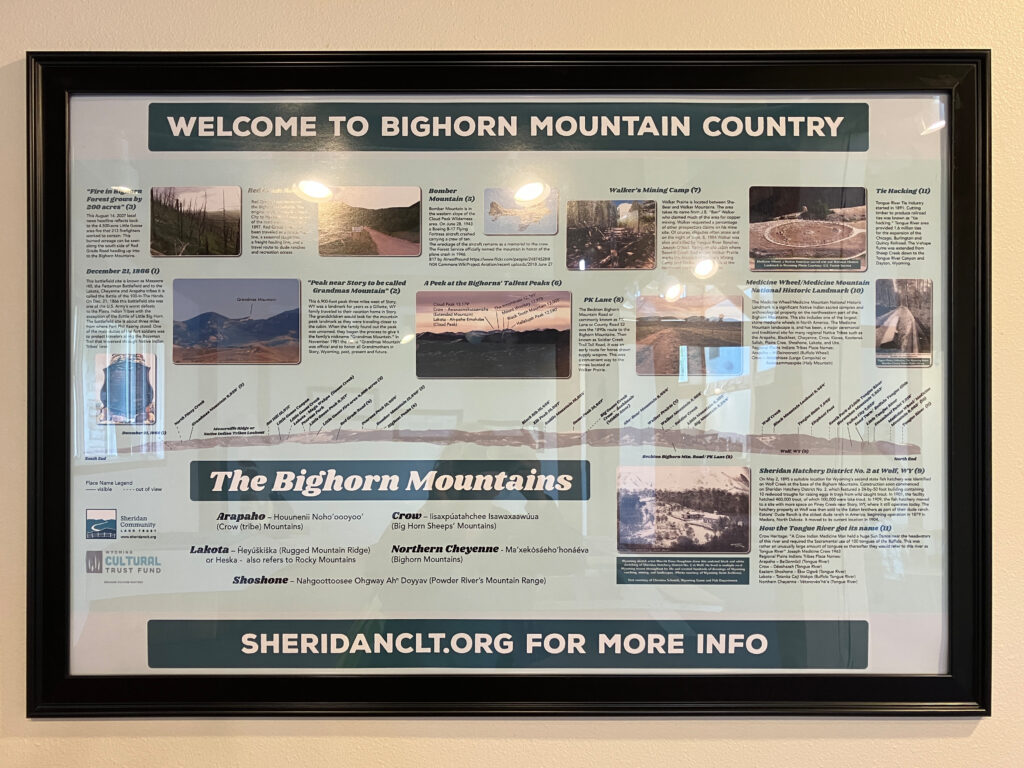
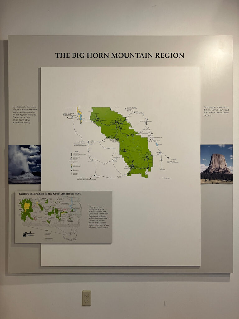
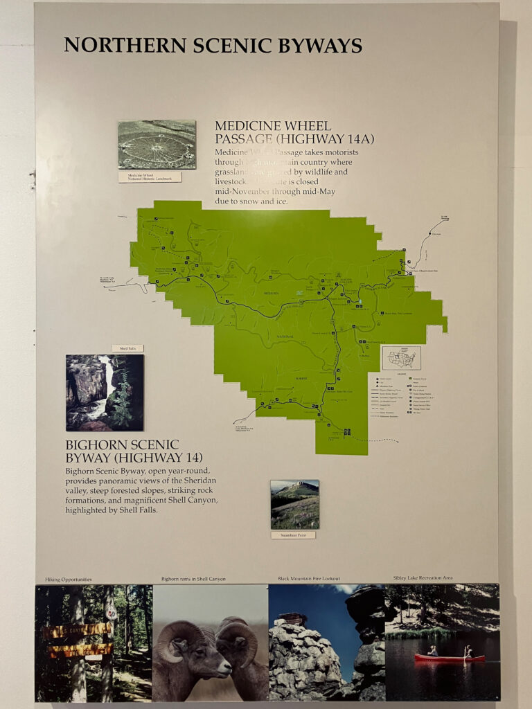
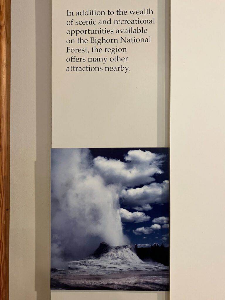
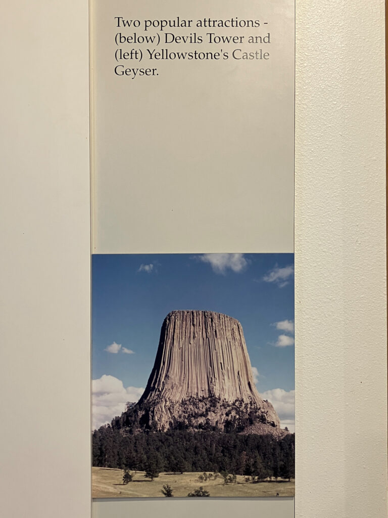
There were also maps of the areas of interest in the national forest and nearby attractions.
And, information about the European and Indian interactions.
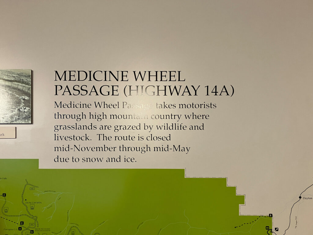
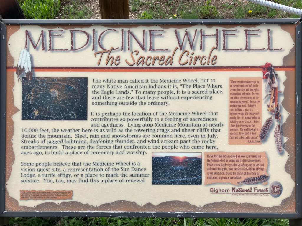
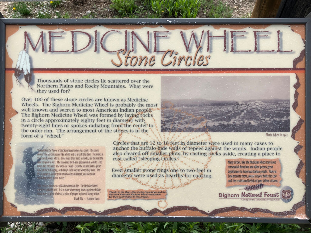
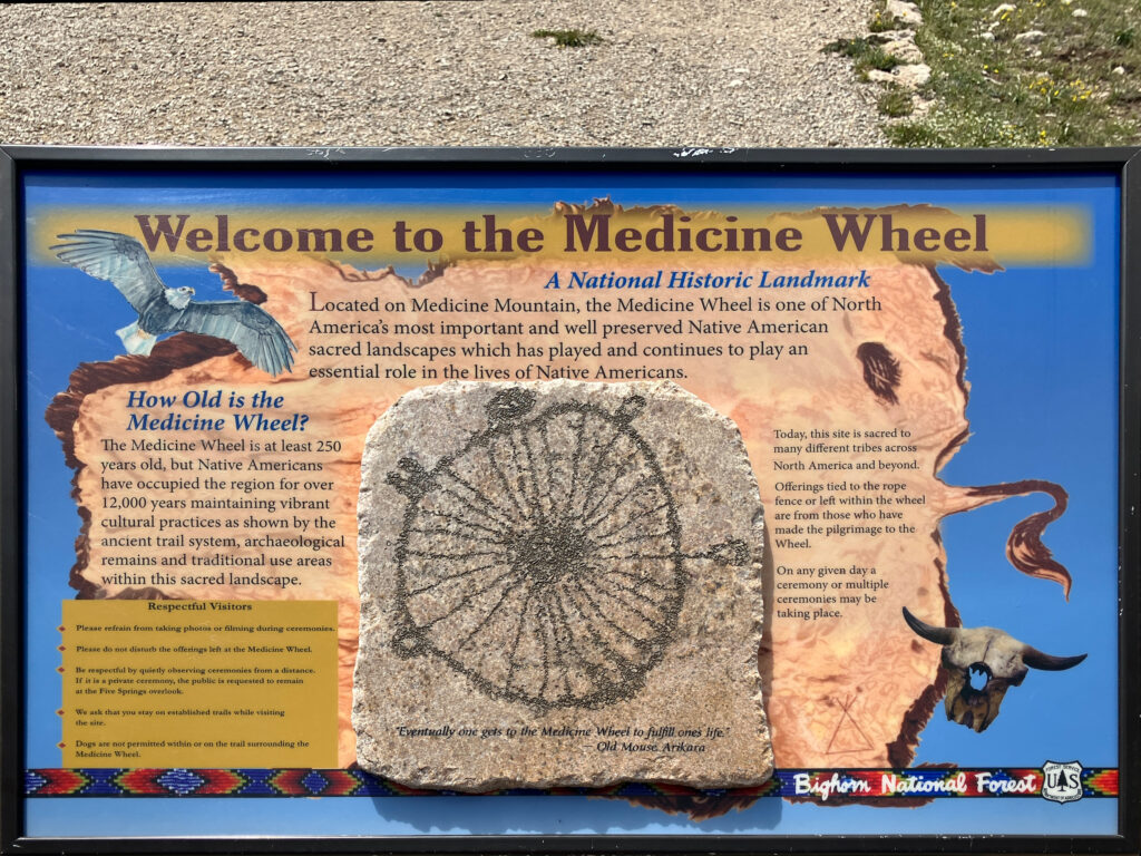
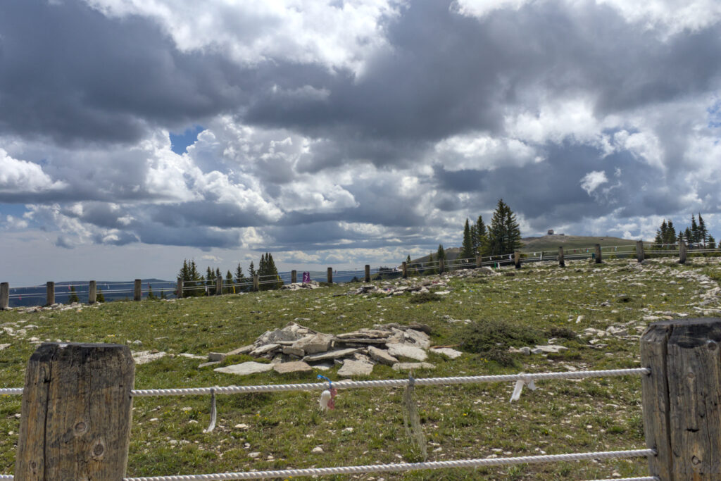
Based on the information at the visitor center, Kate decided that we were driving Alternate Route 14 to the Medicine Wheel. The trailhead was about 30 minutes away, on a dirt road. On this part of the drive, there were no more animals than the first part. At the Medicine Wheel Trailhead, we at least saw a Marmot in the parking lot. At the ranger station, there were two signs about the medicine wheel. It is still an active place of worship, and it may have been used as a place of worship for more than 10,000 years.
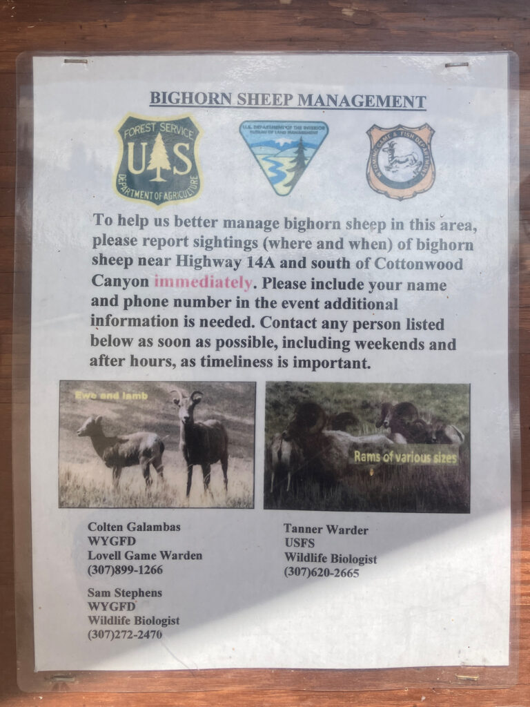
The nearby bulletin board had a sign about Bighorn Sheep. If the wild sheep are getting close to the domestic sheep, the game wardens and biologists need to be alerted. From looking into it, Kate learned that the wild sheep are contracting a disease from the domestic sheep. We never saw any sheep on our visit, so it did not matter.
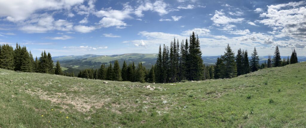
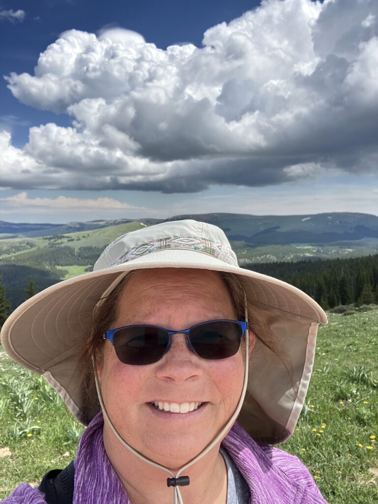
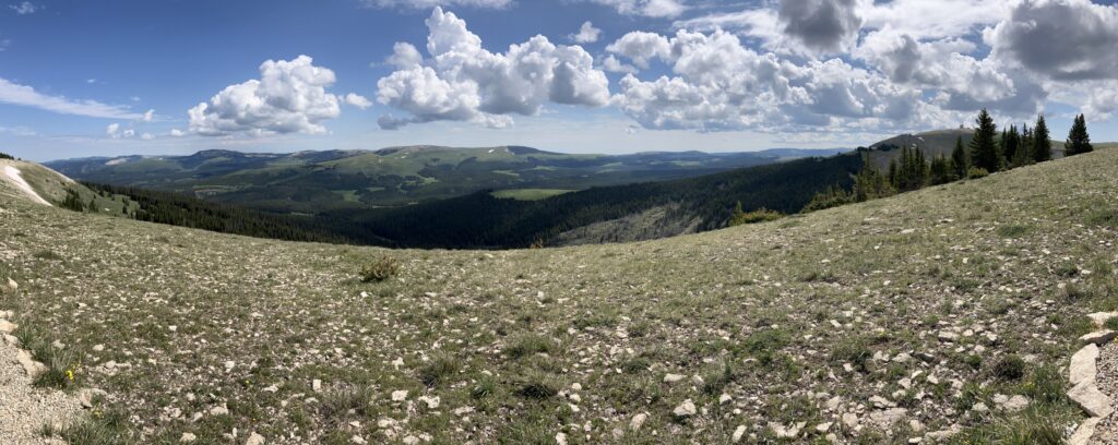
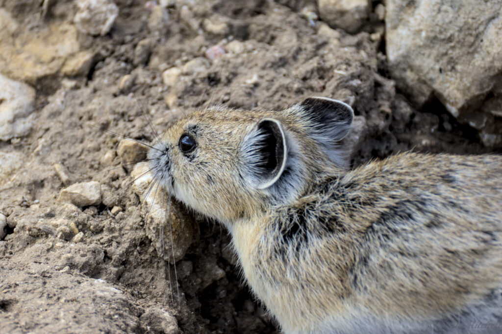
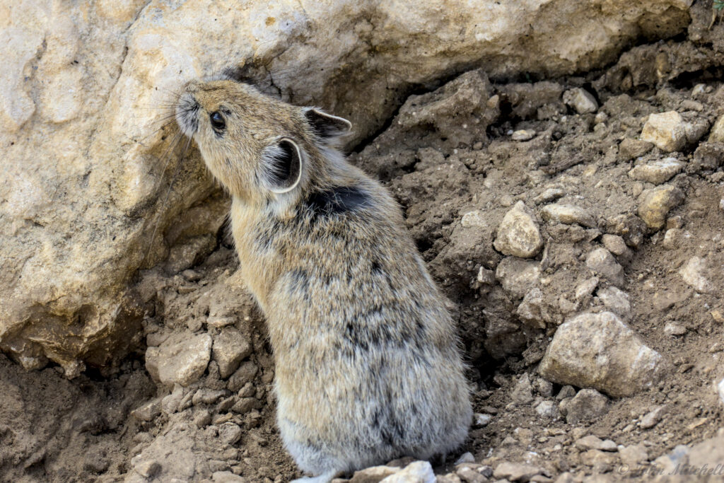
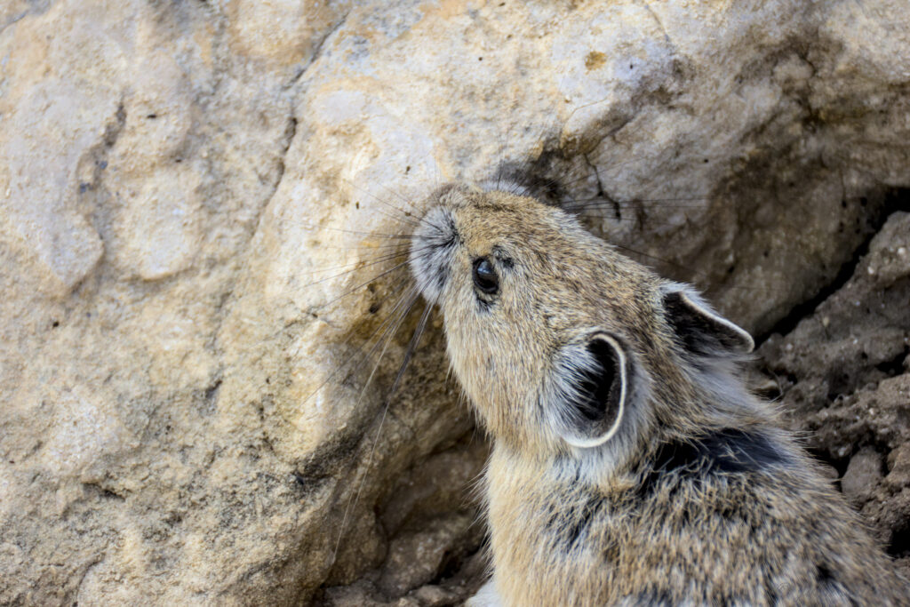
The rocky slopes looked ideal for Pikas, and Kate confirmed their presence with the rangers. We saw a few on the hike out to the Medicine Wheel, but John did not get any good pictures of them. The trail ran across a ridge with view into the mountains and valleys beside medicine mountain.
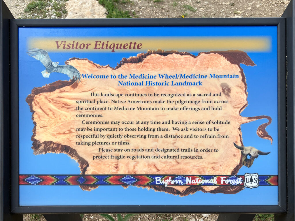
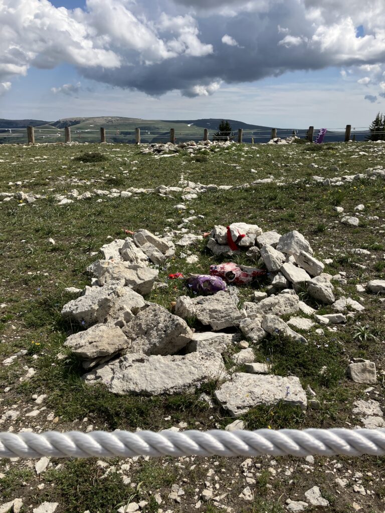
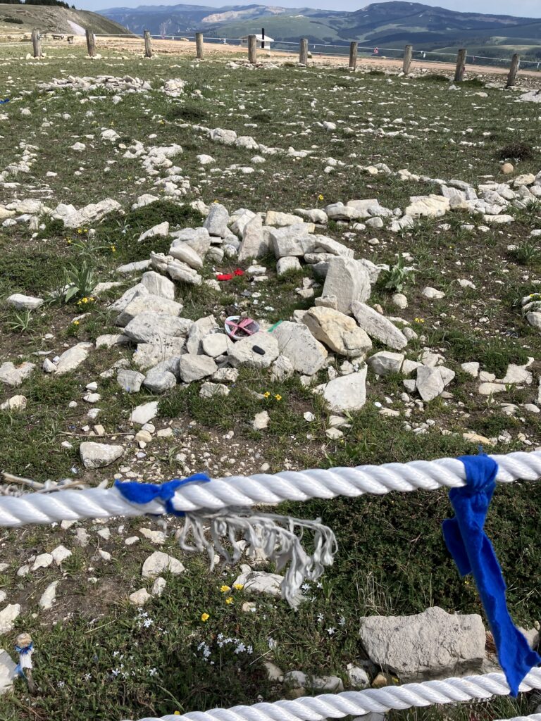
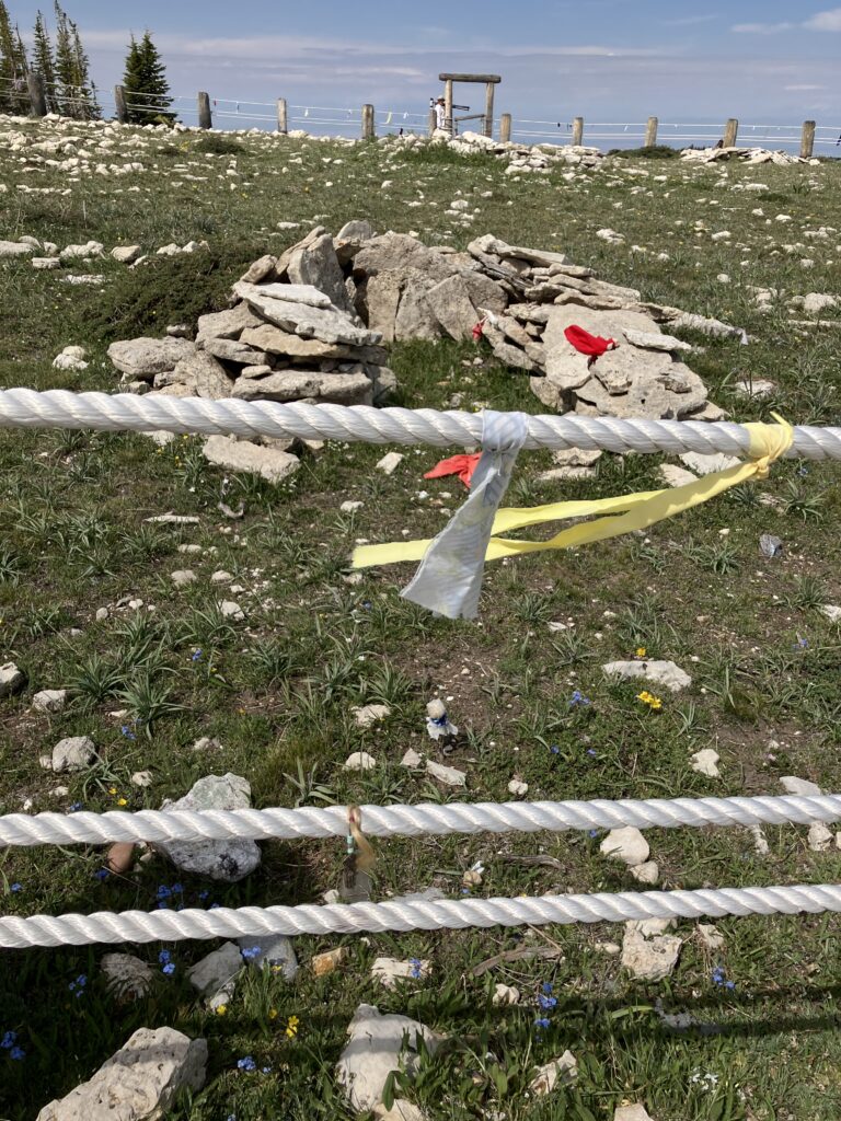
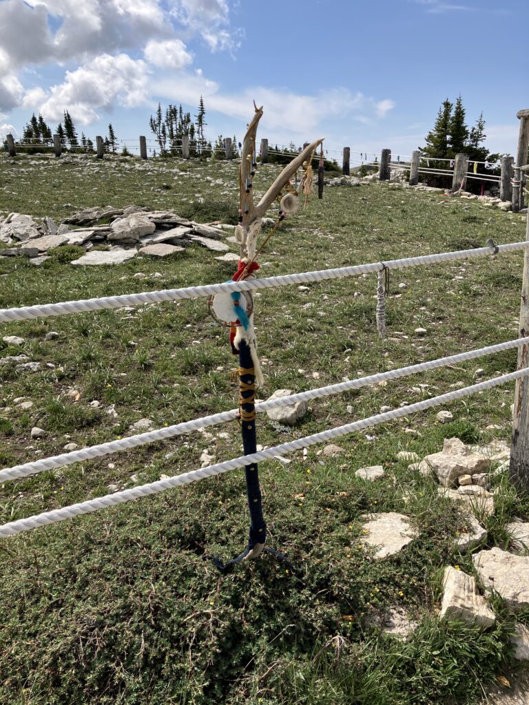
A sign on the path reminds visitors to respect the worship of other peoples.
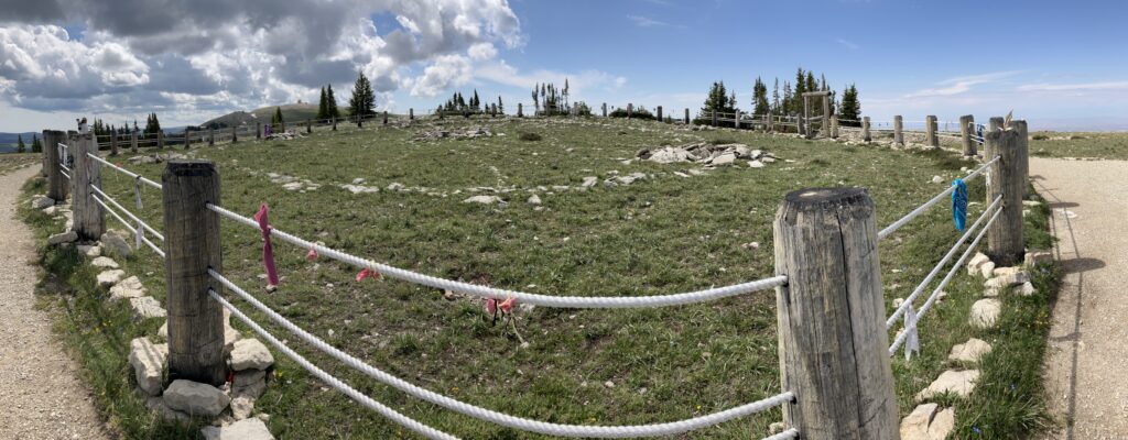
The Medicine Wheel looked quite impressive and modern.
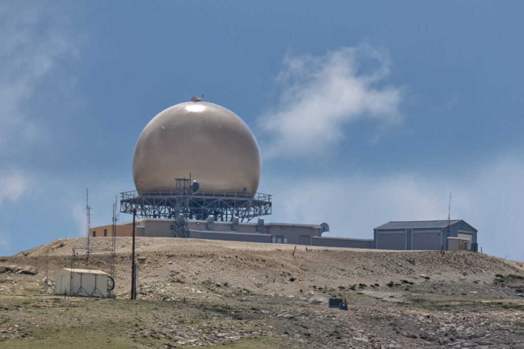
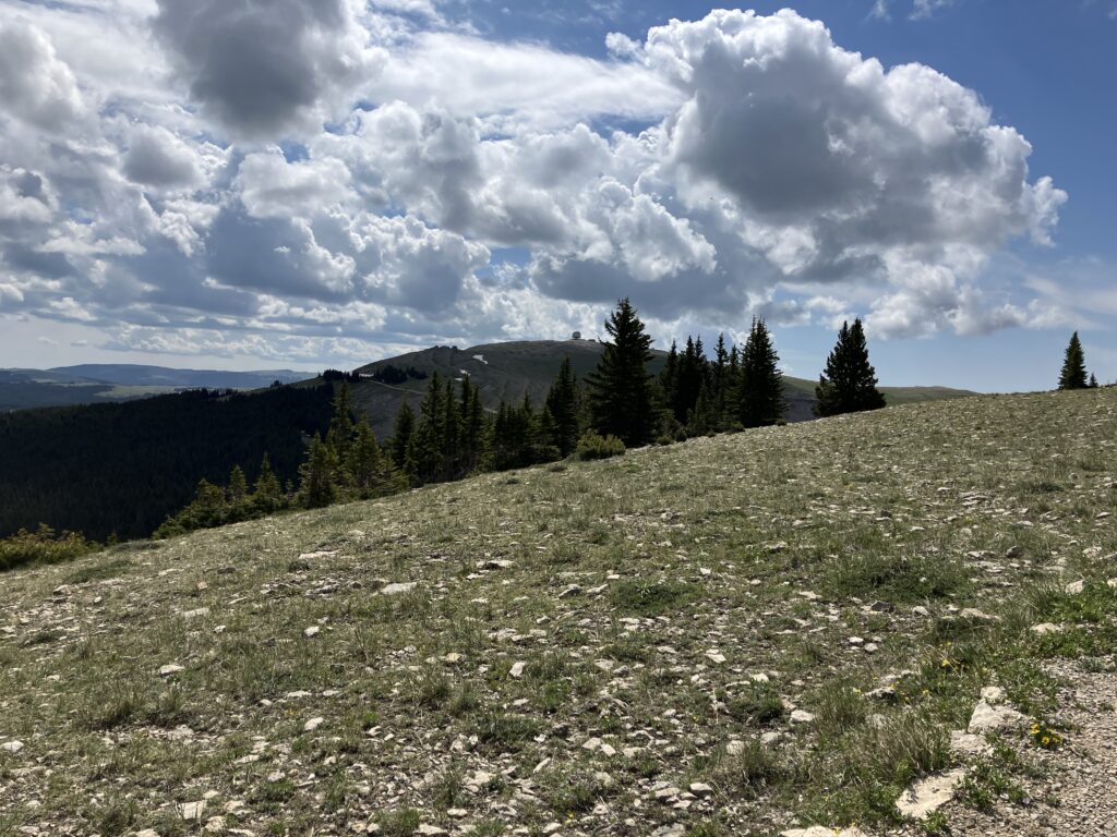
Wait, sorry, wrong picture. That is the Medicine Mountain Research Station. It is visible on the way to and from the medicine circle.

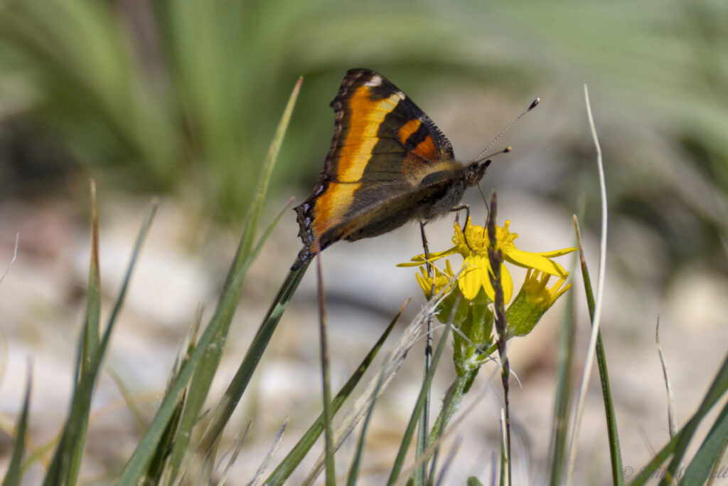
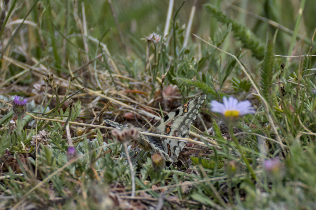
At the Medicine Wheel, there was a field filled with butterflies. John managed to get pictures of a few of them. He is still having trouble with the focus of the R7, so they are not as sharp as he hoped. The first one looks like a Milbert’s Tortoiseshell.
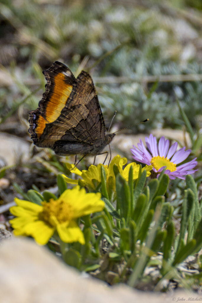
The next one is harder to identify without seeing the underwing. It might be a Mormon Fritillary. but it could be a different Fritillary species.
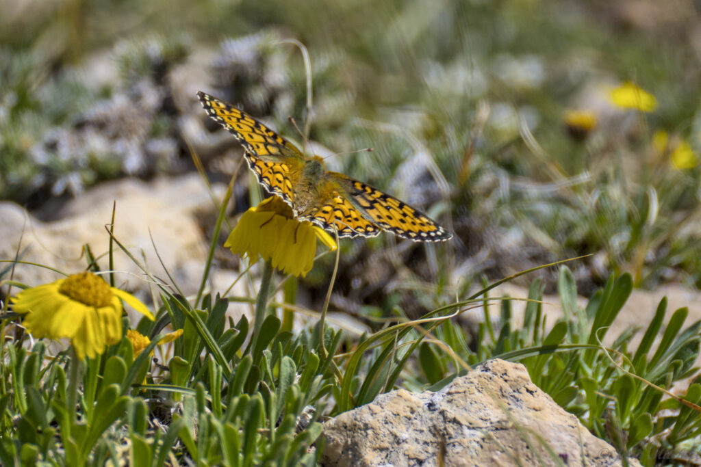
And the last one was a species we had never seen before. It was hard to photograph because it would fly a dozen feet and drop down into the grass. It appears to be a Rocky Mountain Parnassian.
On the hike back, the research station was very prominent on the mountain top.
That does not look very prominent …
… a little better …
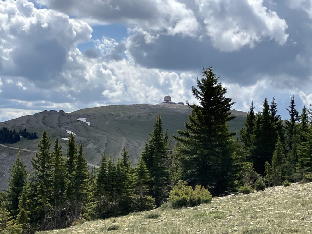
… better …
… that might be a little too prominent. There was also a view of Bighorn Canyon off into the hazy distance. We think that thin red-ish line in the distance on the right is the canyon. Try squinting. (Or try the hi-res link here, but you have to “go back” to get to this page again.)

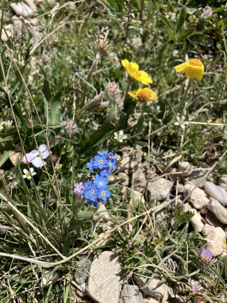
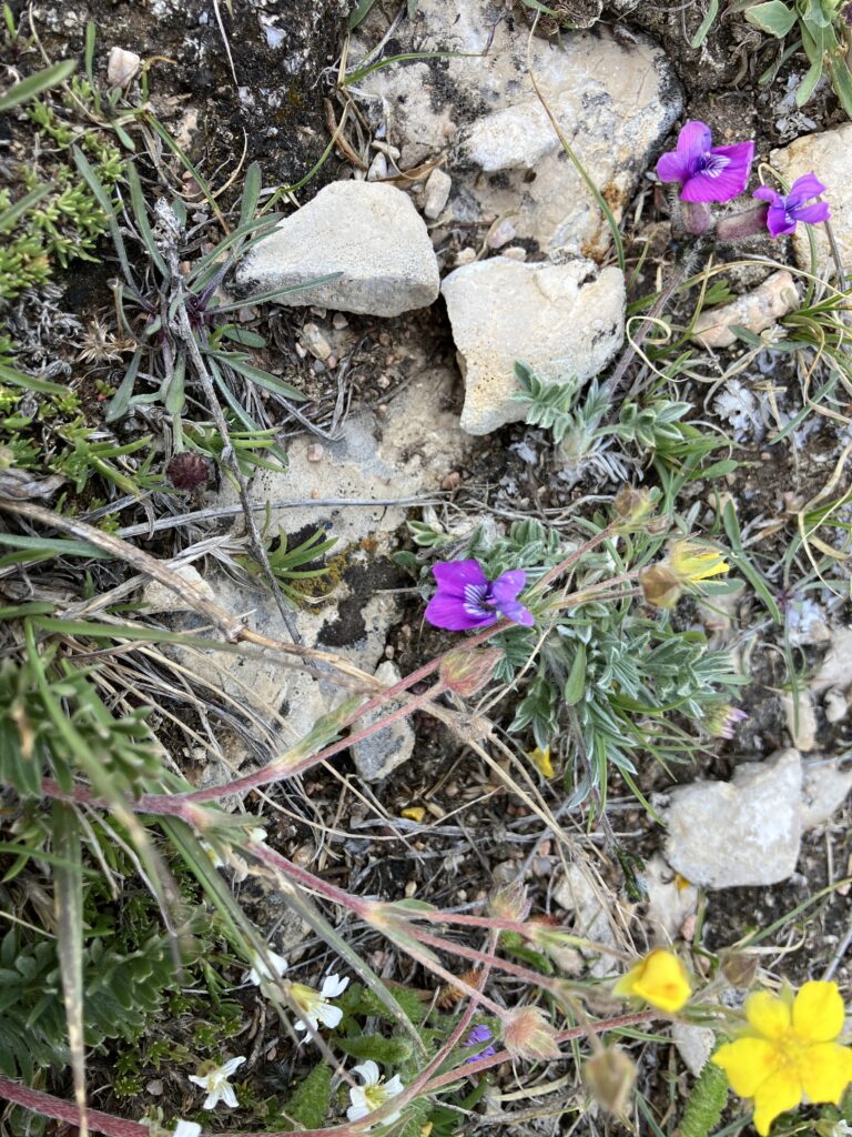
On the hike back we saw wildflowers and Pikas … licking rocks. We have no idea why they were licking rocks, but they were very serious about their rock licking. Maybe it was a salt or mineral shortage. Maybe Bighorn National Forest has bacon flavored rocks. We did not test either of these theories.
Oh, did we mention that there was a stamp for Kate to get here. When John found out, his surprised face looked a lot like this – 😑.
On the drive out of the park, we saw the moose again. Interestingly, they were between the two “Moose on the Road” signs. Either those moose can read, or they cross the road there a lot. Two bulls and a cow crossed the road; they appeared to be the same ones from before. One cow stayed on the other side. She had a light tan face that had a bit of a skull-like appearance.
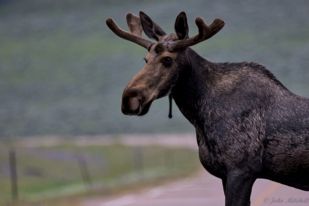
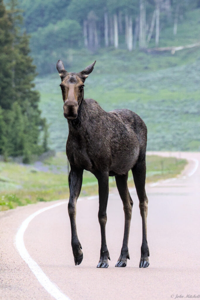
John is glad that moose are not enraged by yellow.
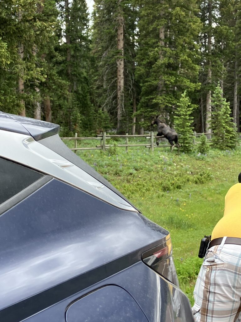
Why did the moose cross the road?
To jump the other fence.