Chippokes State Park, VA, May 2026
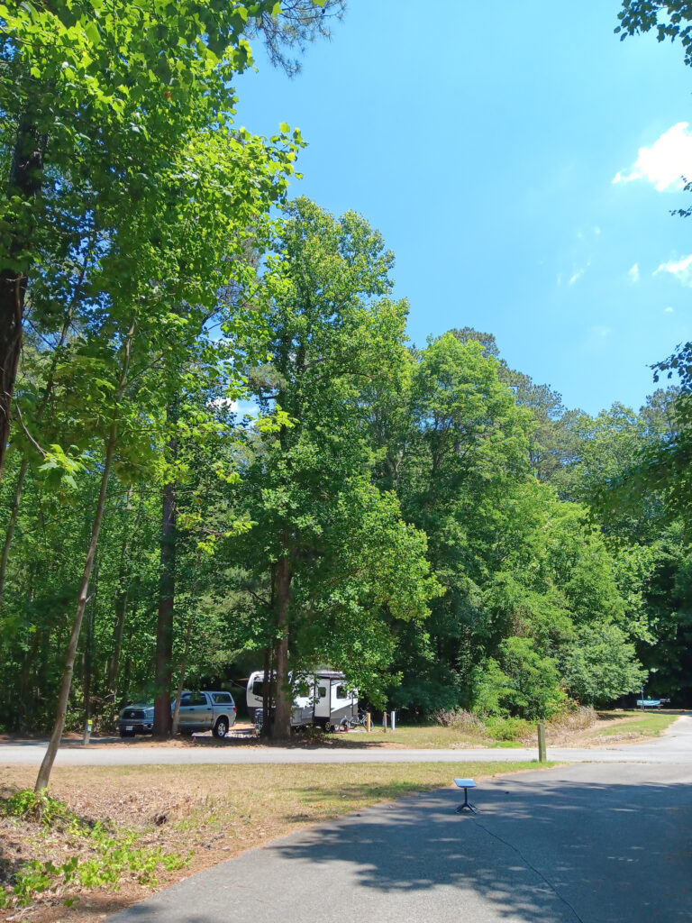
Starlink requires open sky overhead in order to function. Here at Chippokes, the sky looks like this.
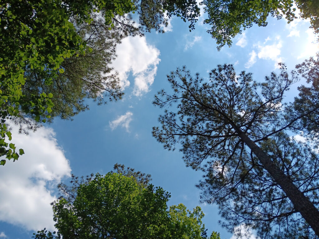
That is pretty much the definition of “not open sky”. Starlink refers to this as “Partially Obstructed”, but it looks “Mostly Obstructed” to me. There is a gap in the trees to the east-ish about 40 feet from the RV, and Starlink should at least function for some streaming TV and internet with partial sky.
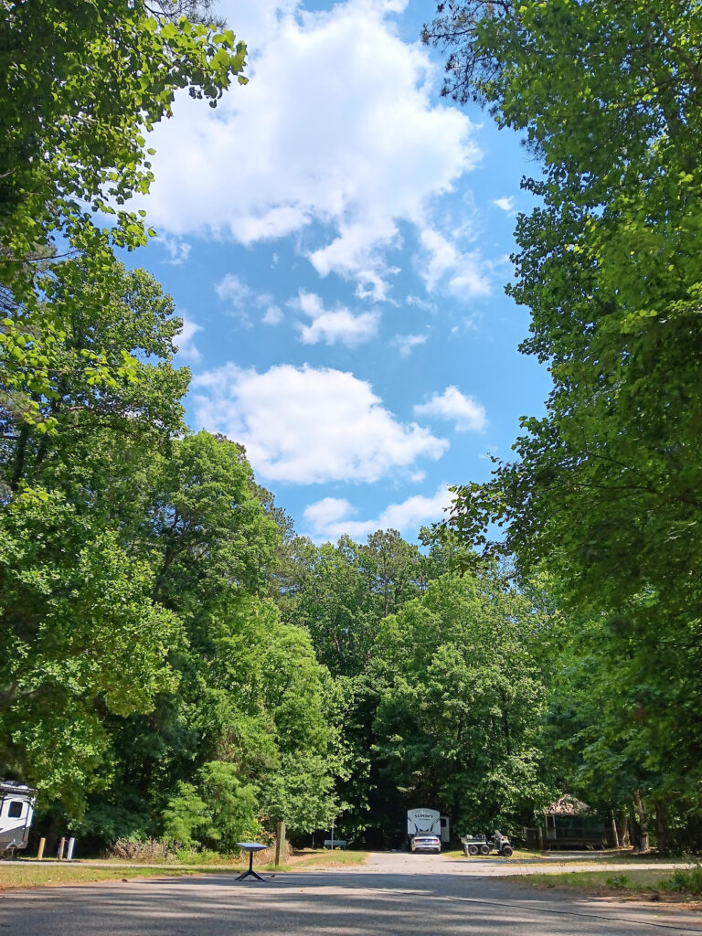
Starlink requires the sky to be open from about 45 degrees to straight overhead. The sky map makes it look like it needs to be open lower, but our experience is that the sky map is a little deceiving. On the phone app, this is what the sky map looks like:
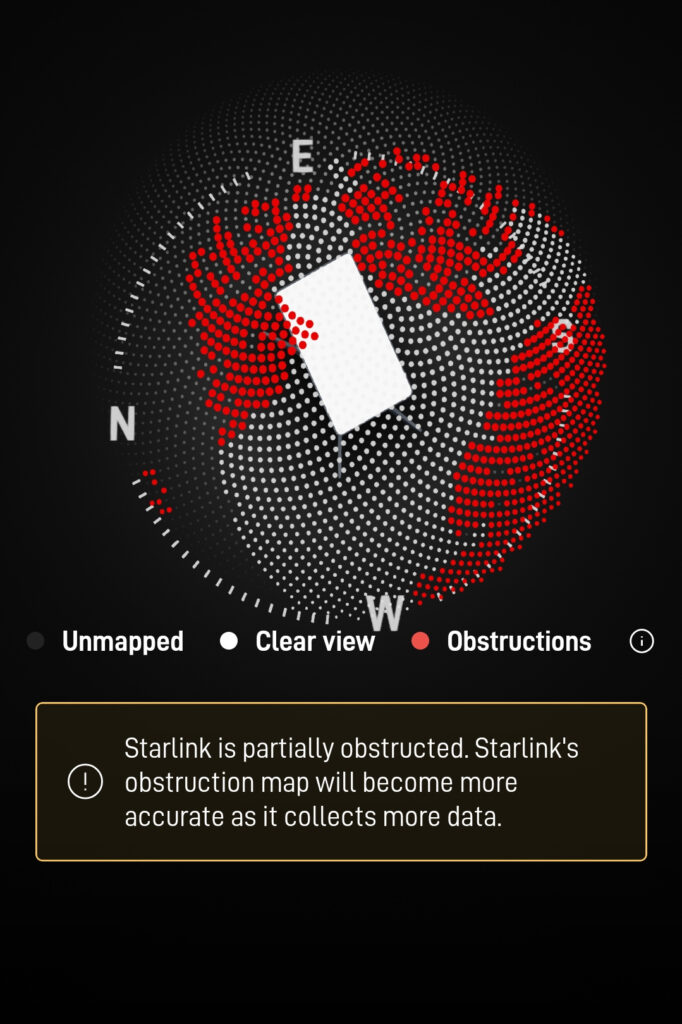
The dots are small segments of sky, not satellites. It is not clear that the orientation of the antenna in the picture matches the actual device, but you can see the gap in the trees and the gap along the road. As to the performance, the statistics look like this:
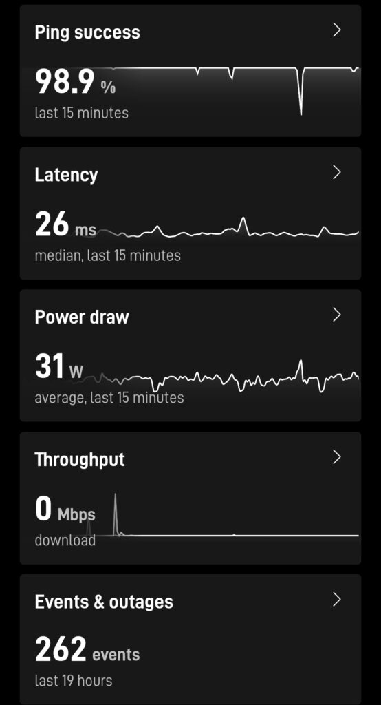
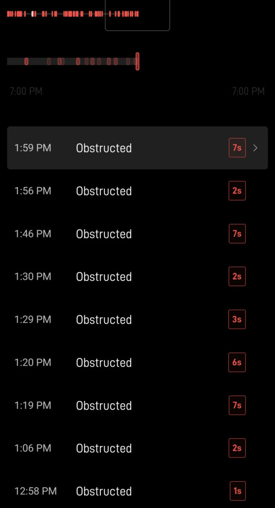
262 events in the last 19 hours, and that is only the events that exceed 1 second long. There are hundreds more that are less than 1 second. What is an event? An event is typically something that interrupts the internet service. There are a few that may not interrupt the internet service, such as a change of IP. It is surprising that we get any internet at all. Amazingly, none of this is very noticeable, unless you hit one of the seven second gaps playing a video games.
How do you go somewhere new and pick a good site? Google Maps, Bing Maps, and Street View are your friend. Be aware that the copyright dates do not always match the picture dates. Sometimes the images of the campground are a decade old with a 2026 copy right. We define a good site as being at least 75 feet long, 12 feet wide, and having clear sky views.
(Note: The next seven images below are from Google Maps and Street View. The copyright is included in the image. The images are unmodified, except by annotations. This appears to be an acceptable use based on the Google guidance found here.)
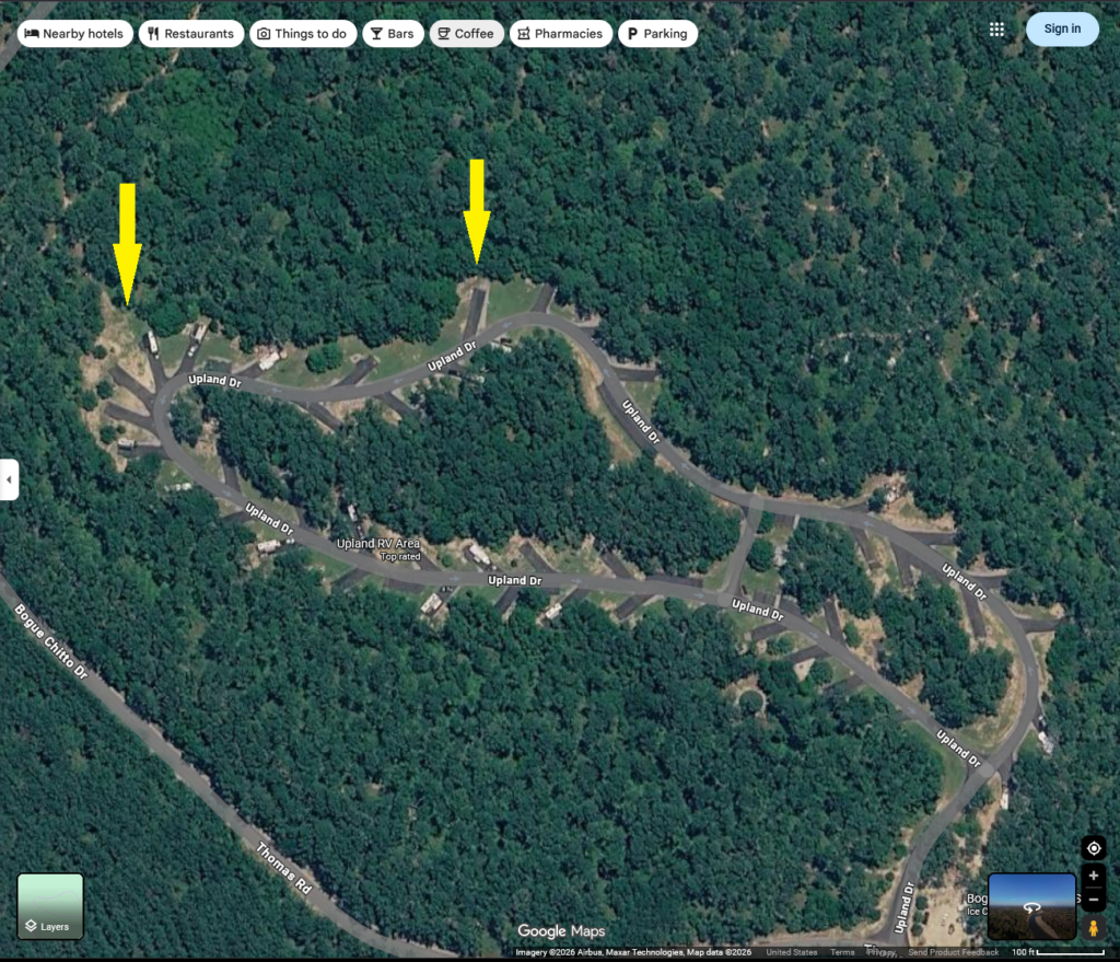
Here at Chippokes State Park, Google Maps and Street View shows you this:
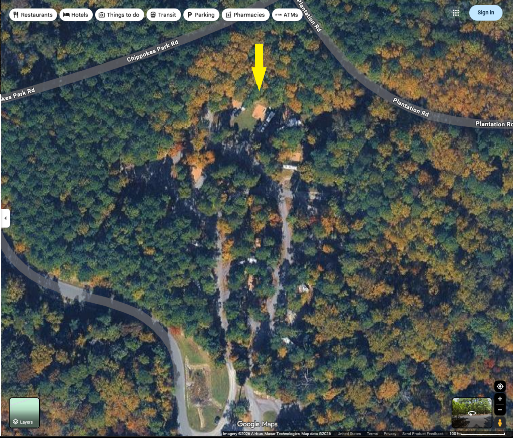
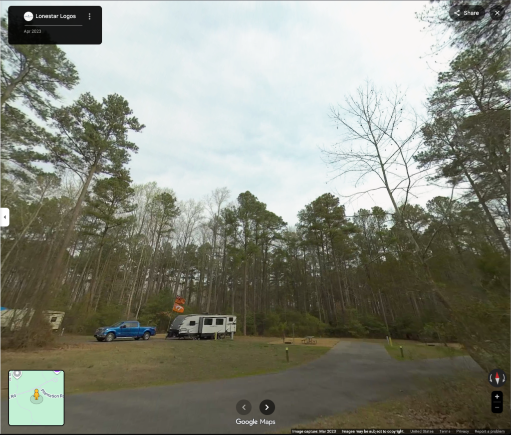
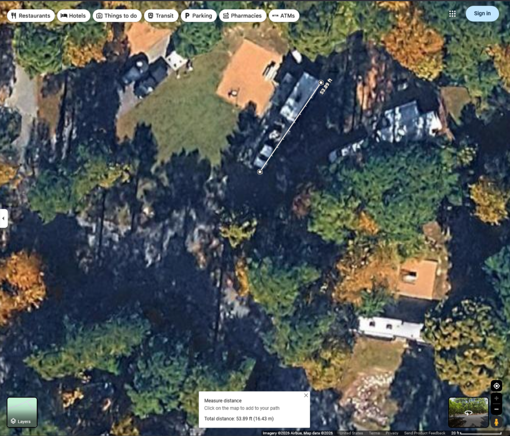
You can see that there is tree cover every where. There is one site (#12) at the top end that looks fairly open. The Street view shows that is is open, but the driveway is a Y with another site. If you do measurements on Google Maps, the site is only about 54 feet long before it hits the connected site. That makes the site too short. The site beside it (#14), is long enough, but it would require putting Starlink in someone else’s site to access the open sky. There were no good sites for Starlink at Chippokes State Park.
Bogue Chitto State Park does have limited Street View, so we were able to pick a good site there. One thing to remember is that Starlink needs a better view to the north than the south, so you want the antenna to be further from the trees north of it. You can see from the overhead view that there are two areas that have enough open area for a decent northern view.
We liked the middle one better because it was a little more secluded. Looking at Street View and measuring distances shows:
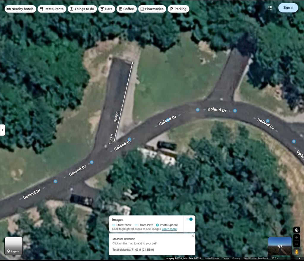
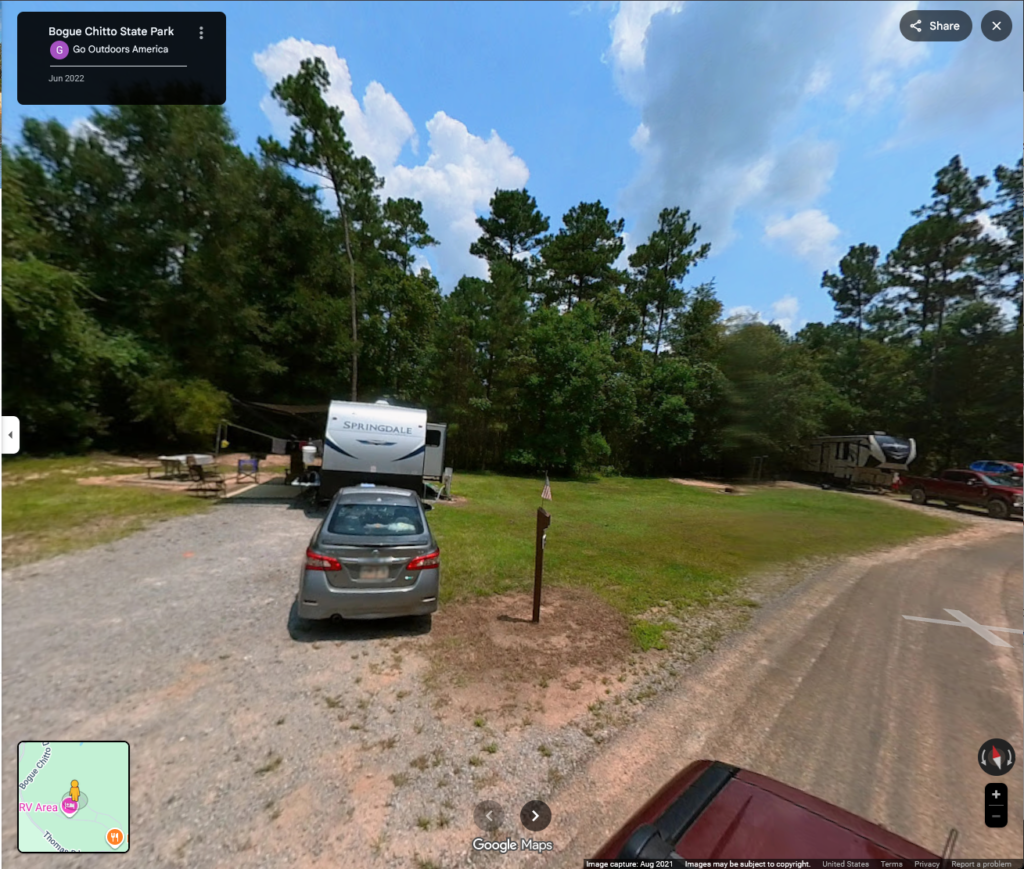
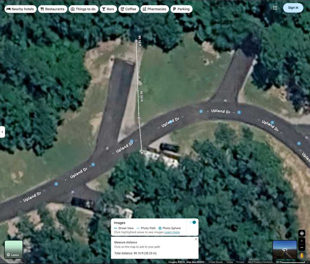
We need a minimum of 75 feet for all of our vehicles, but you can see that the site is only 71 feet. A site less than 75 feet can work if the RV has room to hang off the back of the site, the car can park sideways in the front, or the car can park beside the truck. At this site, the first two options are possible, so it worked fine for the vehicles. The last image shows the distance between the tree canopy on the north and south. The dot in the middle is the rough location for Starlink, so it would have trees 30 feet south and 65 feet north. There was a slight obstruction on the south side, but the internet was mostly good.
Sadly, not all parks have Street View for their park roads. In some cases, you can use other tricks with Google Maps.
- Look for a road that is close enough to estimate the tree heights
- Compare the lengths of the shadows cast by the trees and RVs
- Look for user content around the park showing the trees
- In any views, compare the RV heights to the tree heights
Sometimes , you just have to guess.
Someone, who will not be named (–>![]() <–), said they wanted more math in these posts, so here is some math. If you object to more math, I suggest mailing a flaming bag of dog poop to the unnamed individual. Just be aware that you might have to lie to the post office on the question about “Is there anything dangerous, liquid, or perishable in the package?”
<–), said they wanted more math in these posts, so here is some math. If you object to more math, I suggest mailing a flaming bag of dog poop to the unnamed individual. Just be aware that you might have to lie to the post office on the question about “Is there anything dangerous, liquid, or perishable in the package?”
How do you know that the site will work for Starlink? Remember that we said that we need roughly 45 degrees and above to be open sky? Imagine a right triangle with a 45 degree angle.
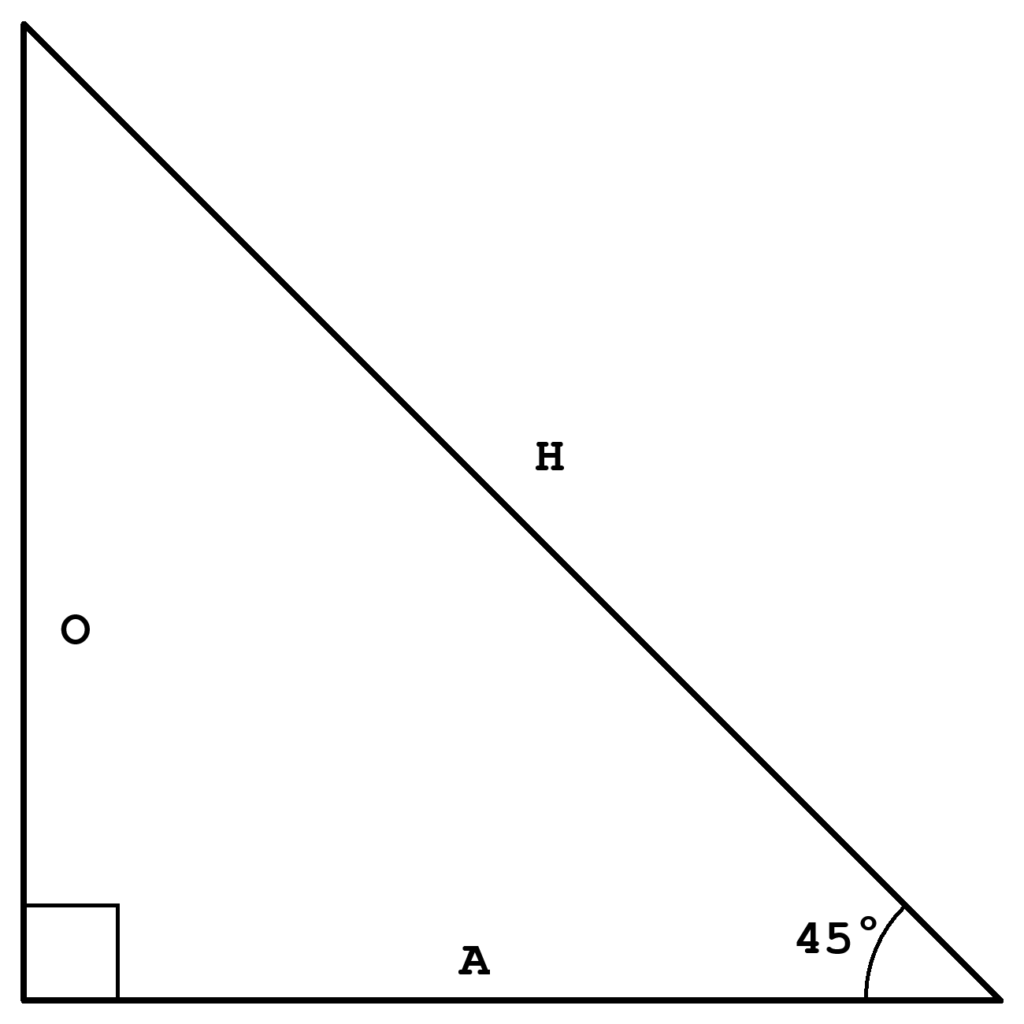
Good imagination!
From the previous math posts (that I know you studied diligently), the length of the opposite side, O, is sin(45 degrees) * H = .7071 * H, and the length of the adjacent side, A, is cos(45 degrees) * H = .7071 * H. Notice that the lengths of the sides are the same. (FYI, this is an isosceles right triangle.)
So what, right?
Why this is useful is that it tells you how far to place Starlink away from a tree in order to have no obstructions. If you have 65 foot tall trees (i.e., the length of O), you want Starlink to be at least 65 feet from the edge of the tree canopy (i.e., the length of A). This is something you can measure on Google Maps. Small trees seem to be about 10-40 feet tall, medium trees 40-70 feet tall, and large trees 70-100 feet tall. If you mount Starlink on a pole on the back of the RV, you gain 10-15 feet of height to view over the trees.
That was not really enough math was it?
In the park, you can use the same method to estimate the height of the trees. In Boy Scouts, we learned how to measure the height of a tree from the ground with a stick. You need a method of estimating shorter distances, such as the length of your stride or length of your shoe. Having a walking stick that is an exact length can be useful too,
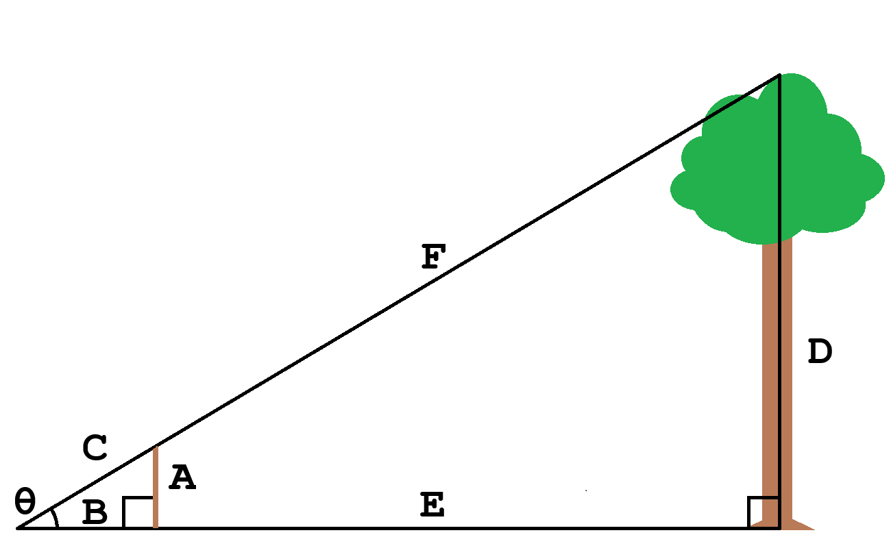
A is the length of the stick. C is the height of the tree. B is the distance from your eye to the stick. D is the distance from your eye to the tree. From the previous information, we know that the adjacent side is the hypotenuse times cosine of the angle, and the opposite side is the hypotenuse times sine of the angle. If you divide the opposite side by the adjacent side for each triangle you get:
(A / B) = {[sin(θ)*C] / [cos(θ)*C]}
(A / B) = [sin(θ) / cos(θ)]
(D / E) = {[sin(θ)*F] / [cos(θ)*F]}
(D / E) = [sin(θ) / cos(θ)]
You might notice that the ratio of the sides is the same, sin(θ) / cos(θ), and this is known as the tangent, tan(θ). This means that:
A/B = D/E
So what? This means that we can use a little triangle to measure a big triangle. You can do this standing up, but I sprawled on the ground. The pavement was warm. STOP JUDGING ME! If you are standing, add your shoulder height (and any rise or fall of the ground) to the tree height
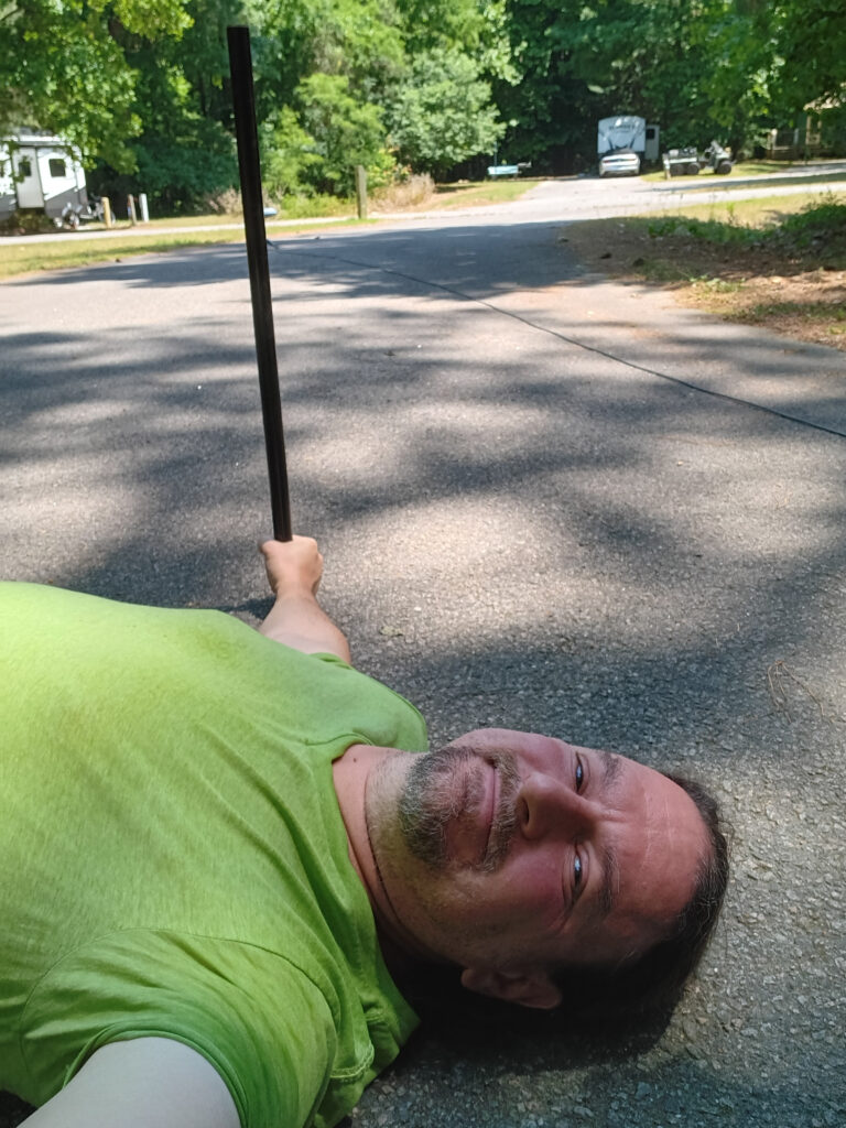
Using the eye closer to the ground, position yourself so that the tip of the stick is at the top of the tree while the pole is vertical. (This is one reason it is easier to to standing, but your arm has to be straight out and the pole vertical.)
Now, you have to walk all the way to the tree while you count the paces.
For me, it was 40 paces, and my paces are about 2.25 ft. Using the length of the pole and distance from my eye to my hand, which are both about 30 inches.
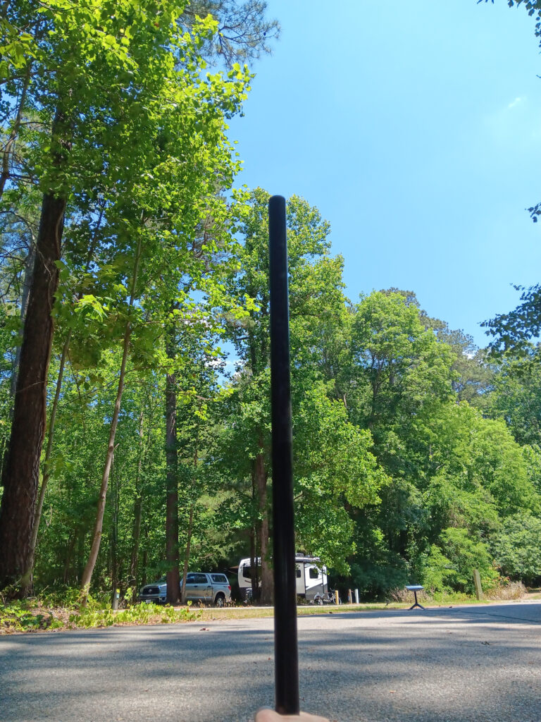
(30 in / 30 in) = (D / 90 ft)
1 = (D / 90 ft)
90 ft = D
That tree is about 90 feet tall. This is just an estimate, but it is likely at least 80 feet to 100 feet tall. If you look at the red blob on the right side of the sky map above, that is probably the tree that I just measured. Starlink is 1/3 closer than I was, so it is only about 65 feet from an 80 foot to 100 foot tall tree. It needs to where I was measuring from to clear that tree. Sadly, at that location, it would hit other trees instead.
The modern way to do this would be with a laser range finder. Measure the distance to the tree bottom and tree top, and you can calculate the height. Or just fly over it with a drone and use a laser range finder.